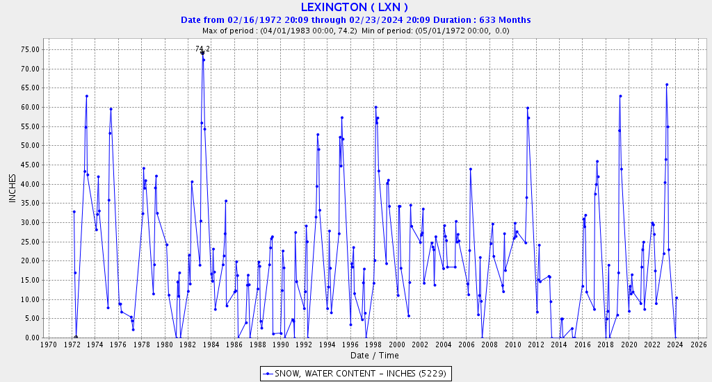
And Lexington Hill, above La Porte (this snow course is monthly only):
The annual records:
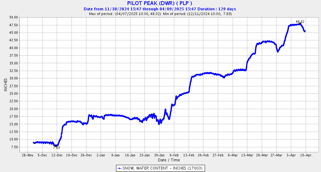
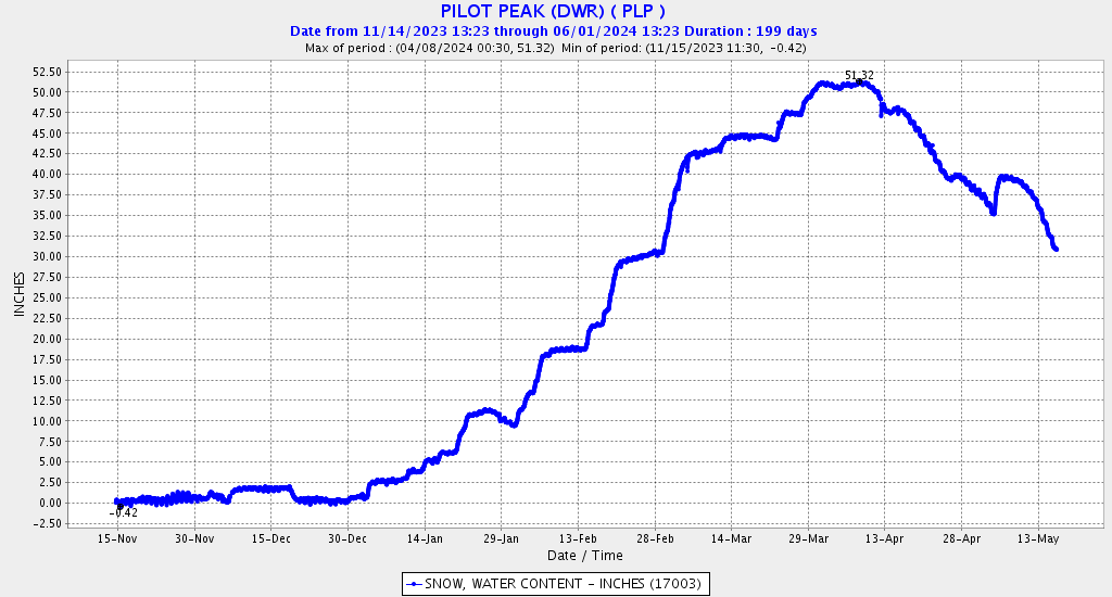
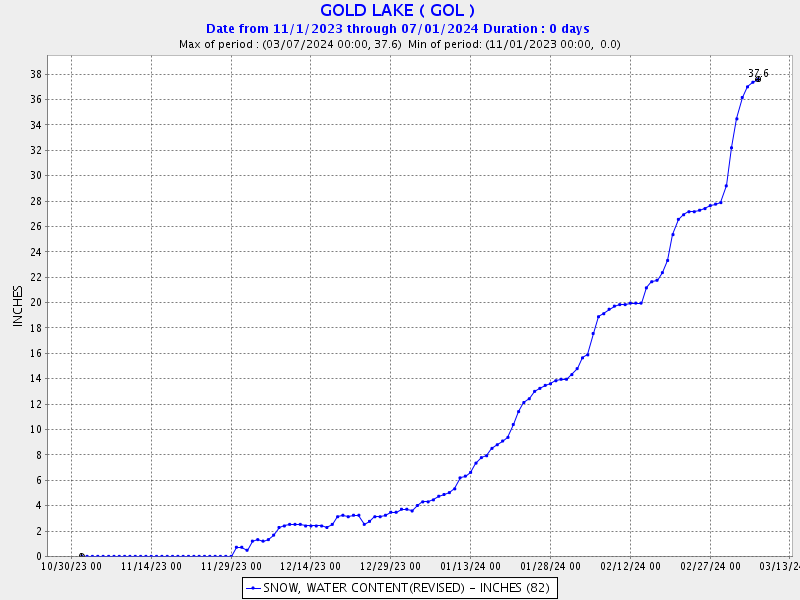
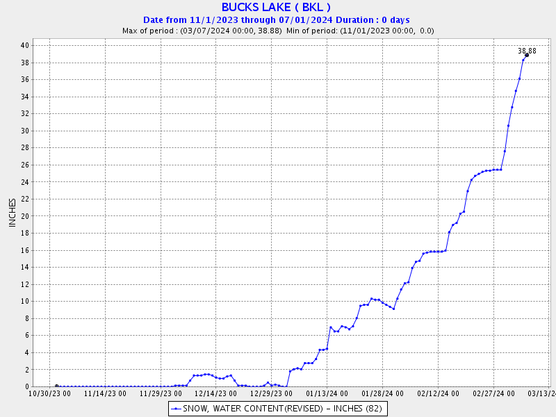
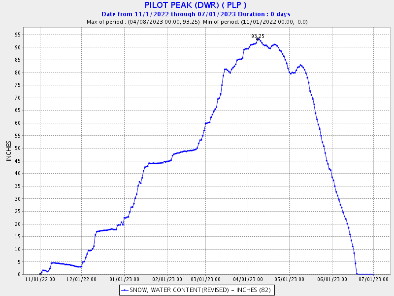
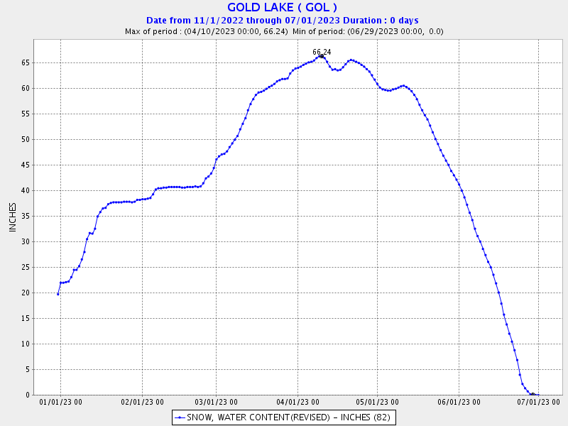
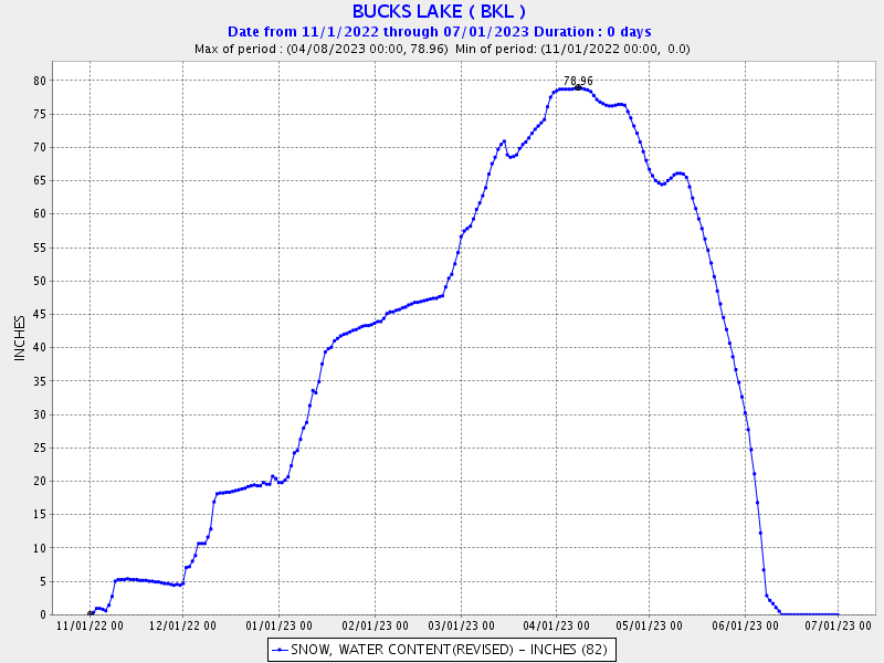
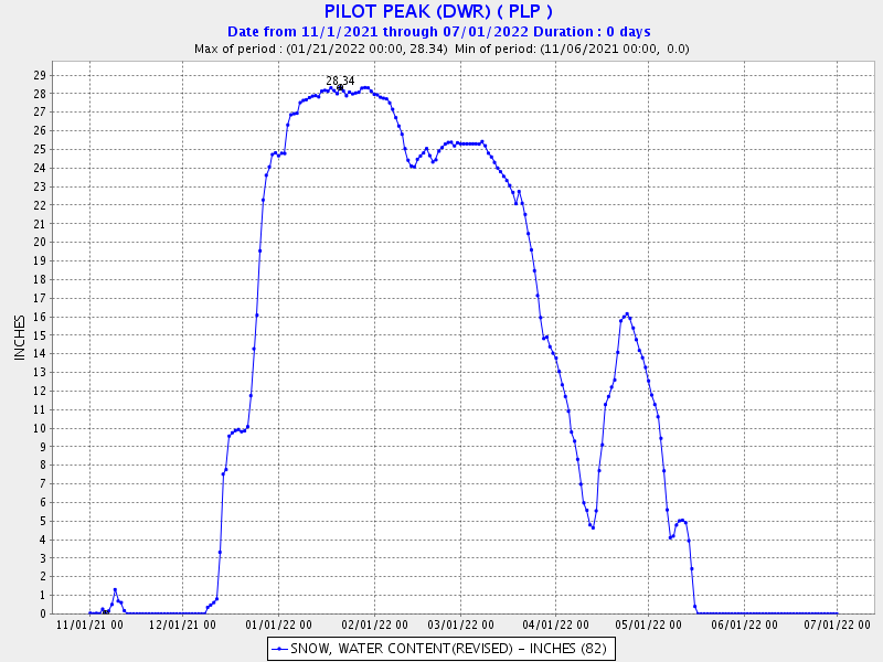
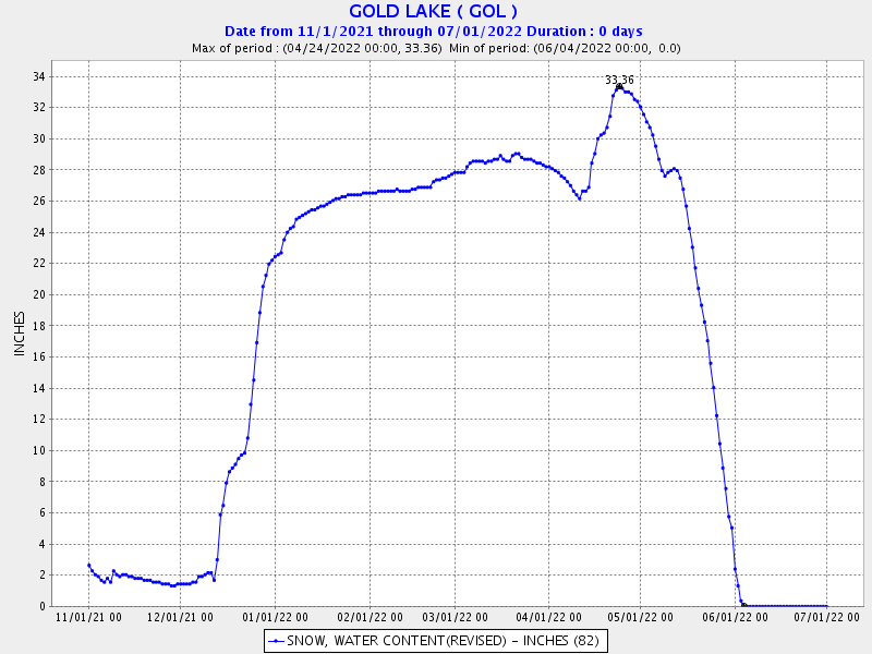
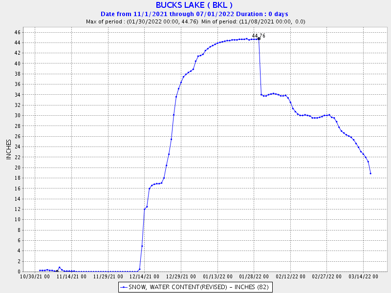
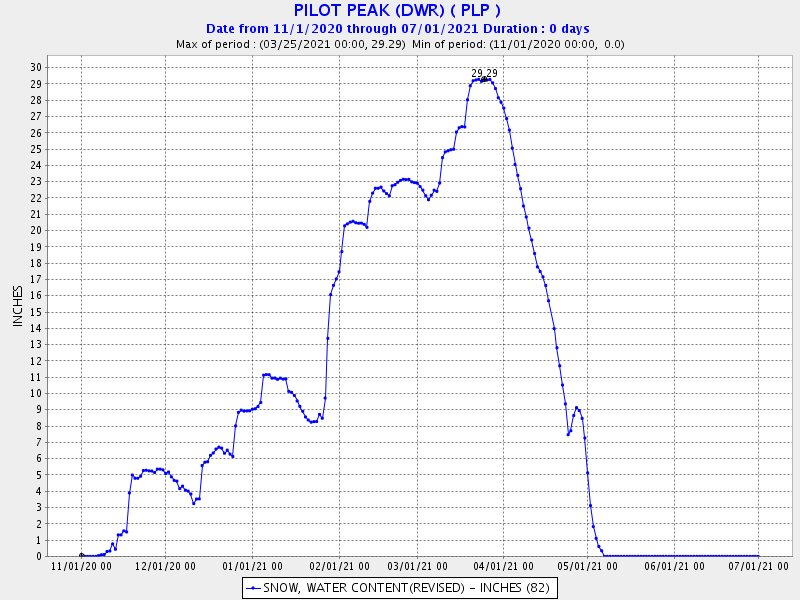
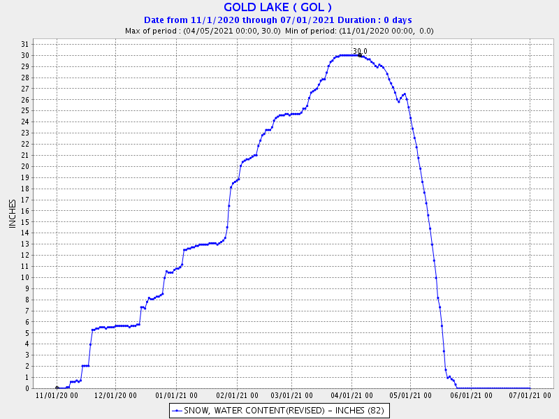
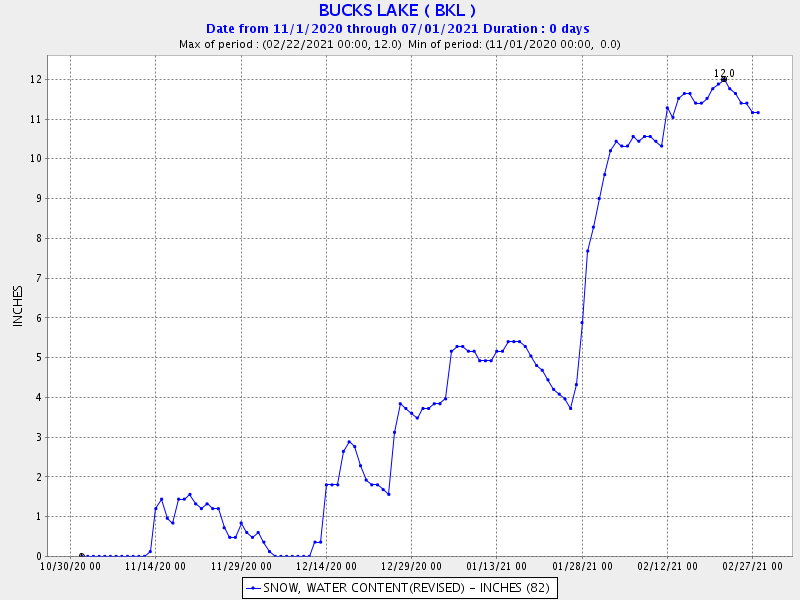
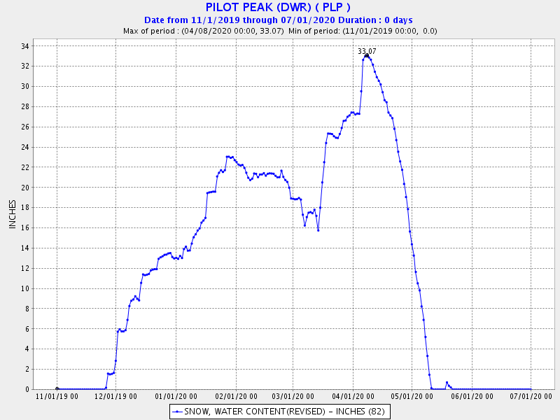
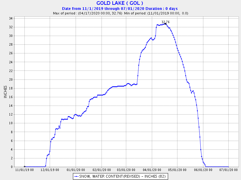
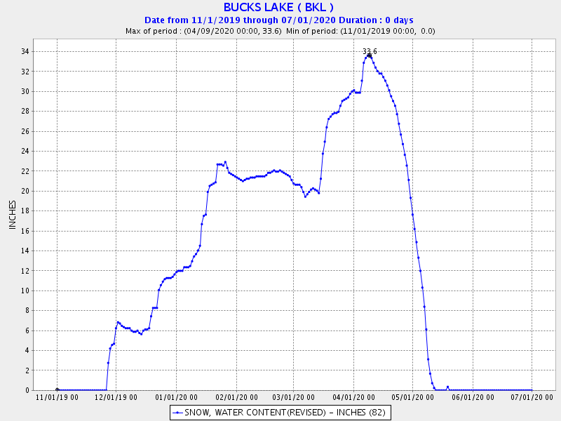
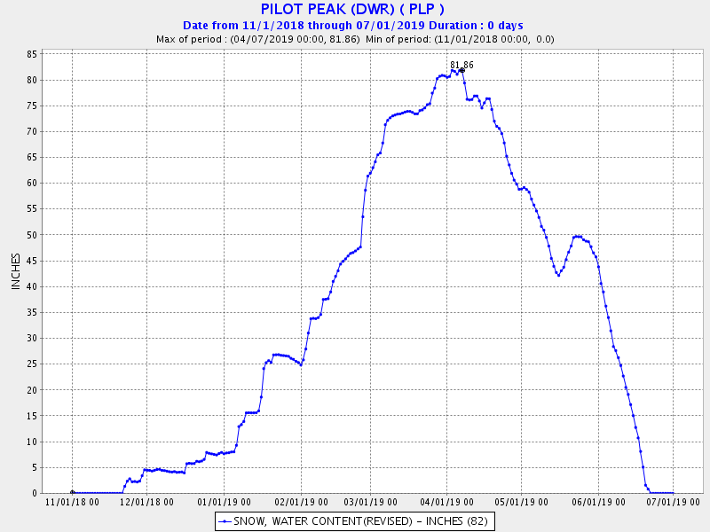
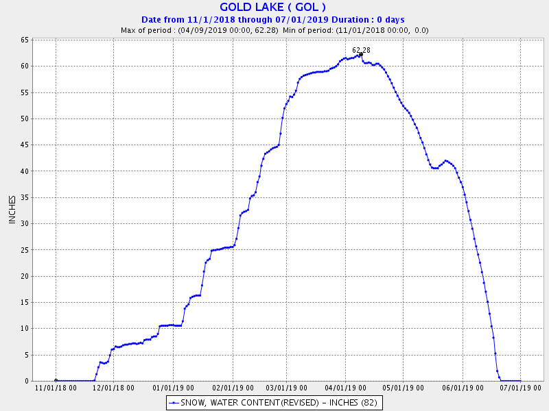
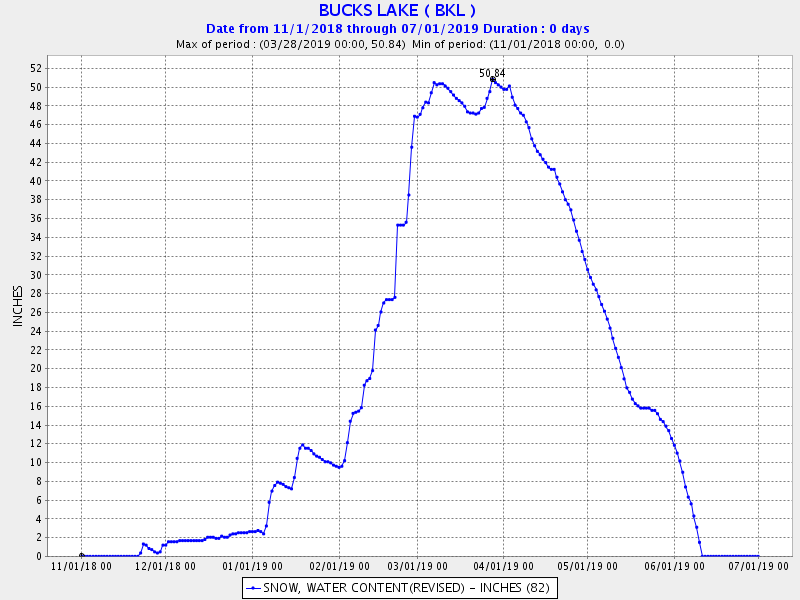
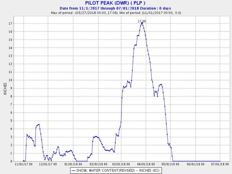
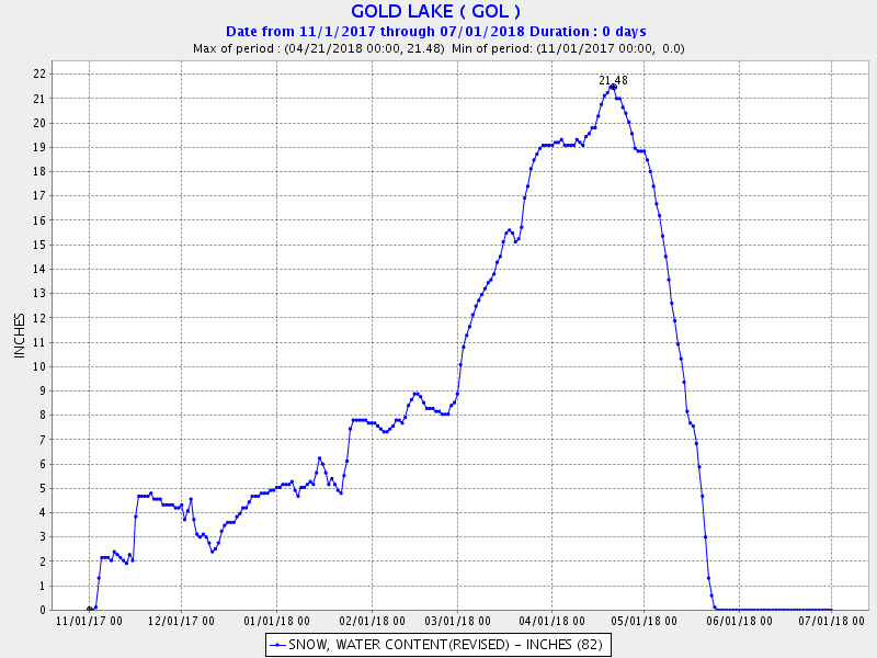
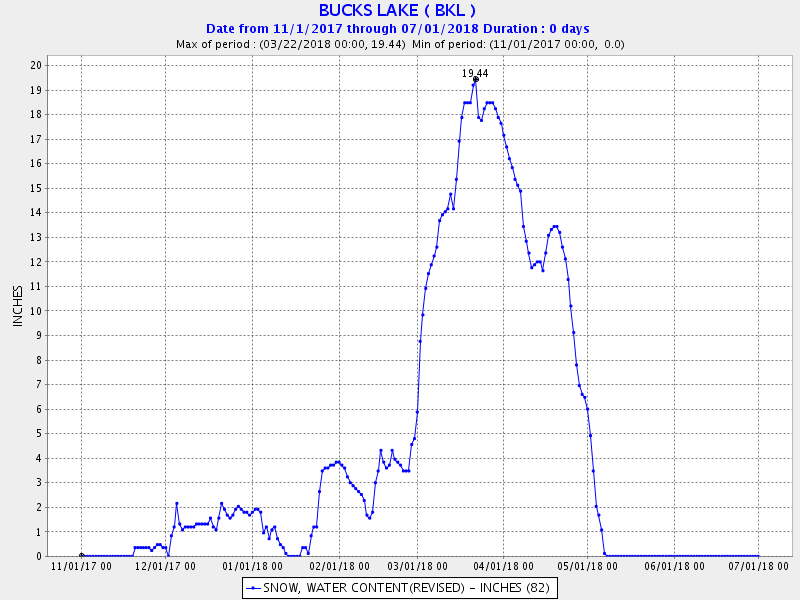
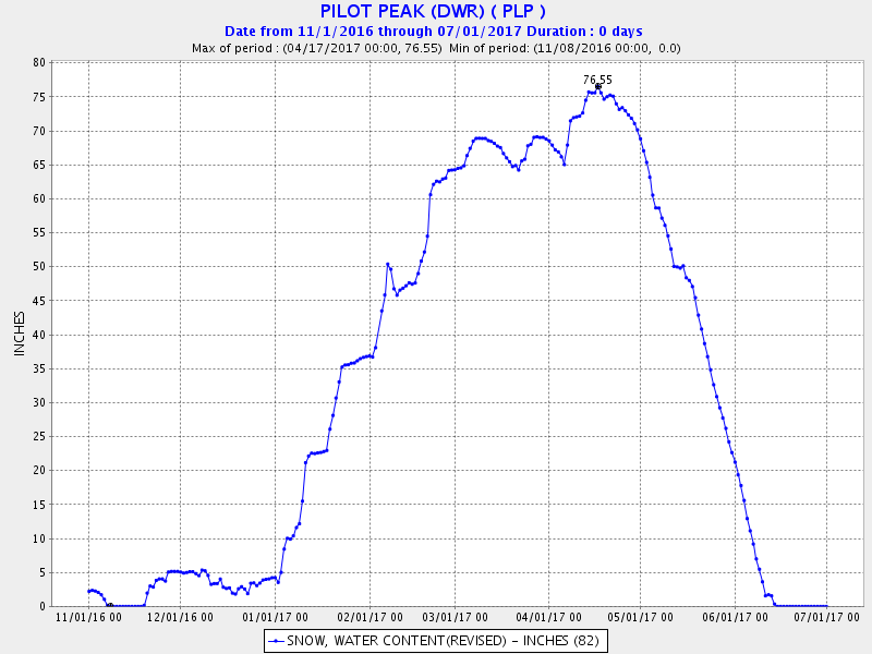
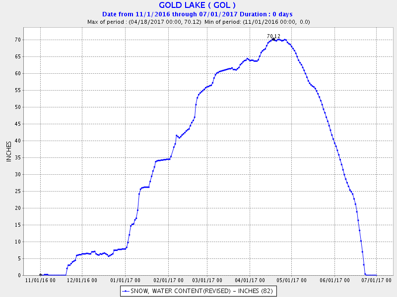
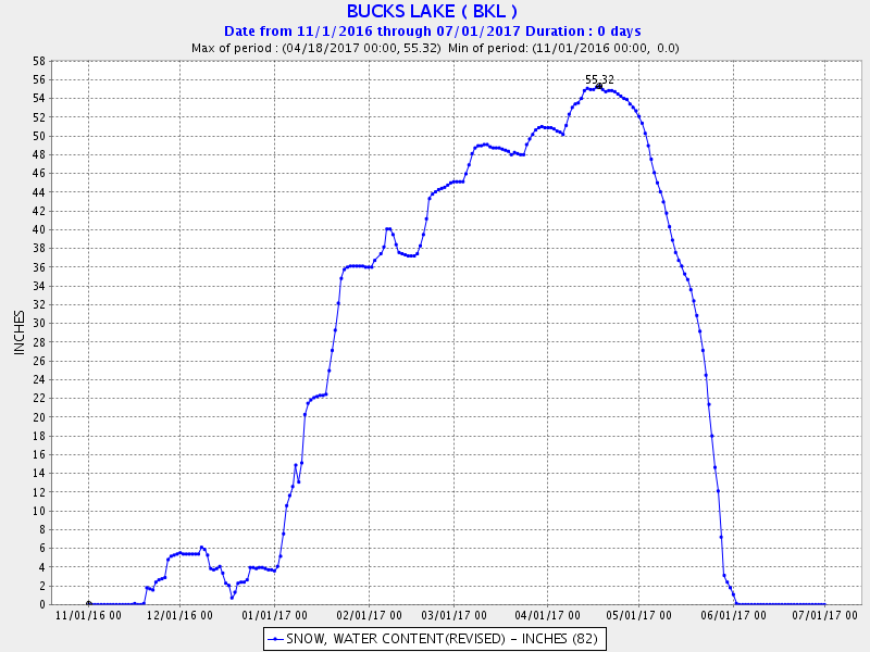
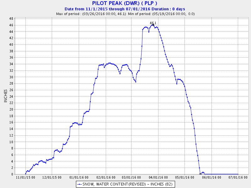
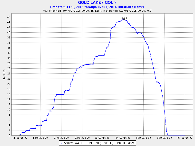
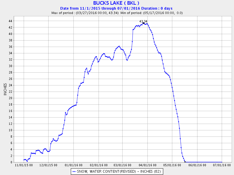
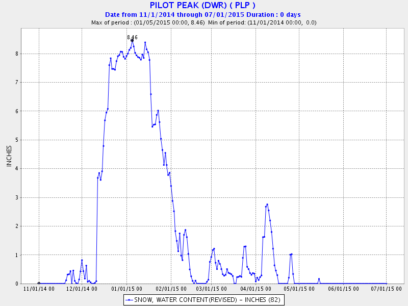
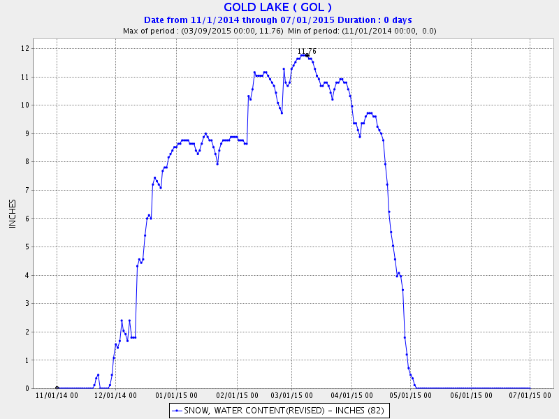
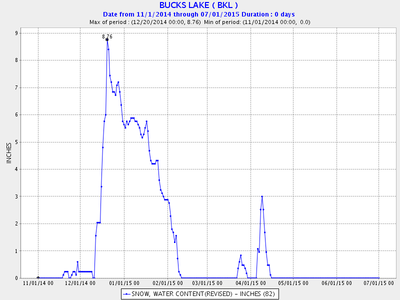
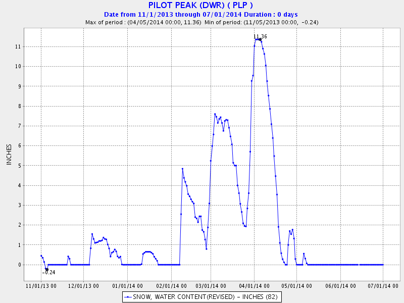
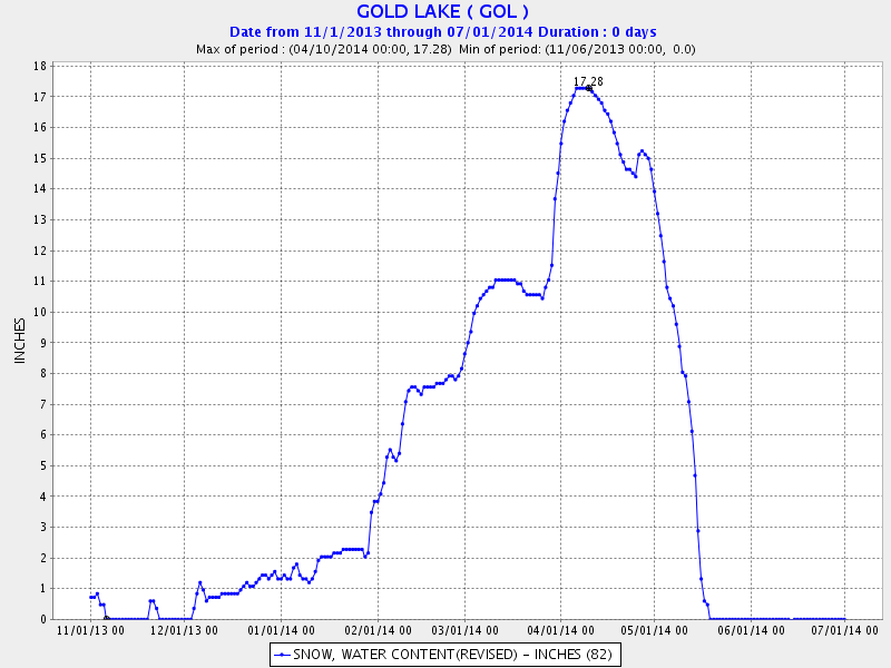
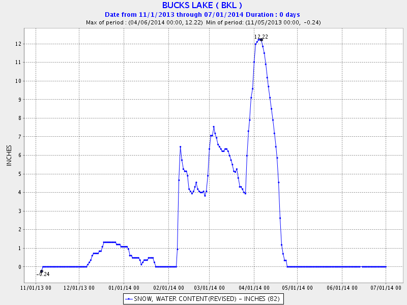
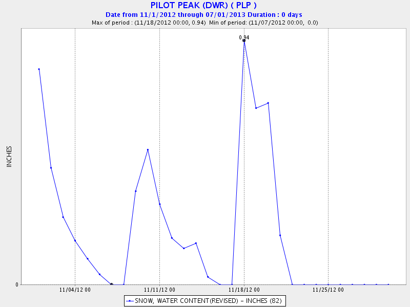
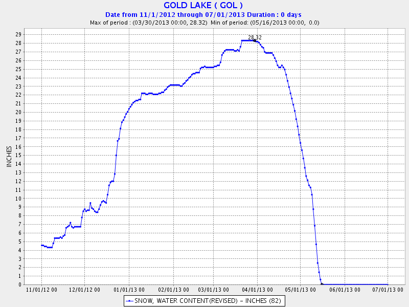
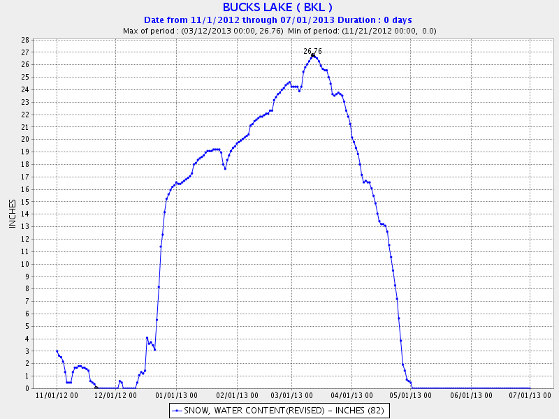
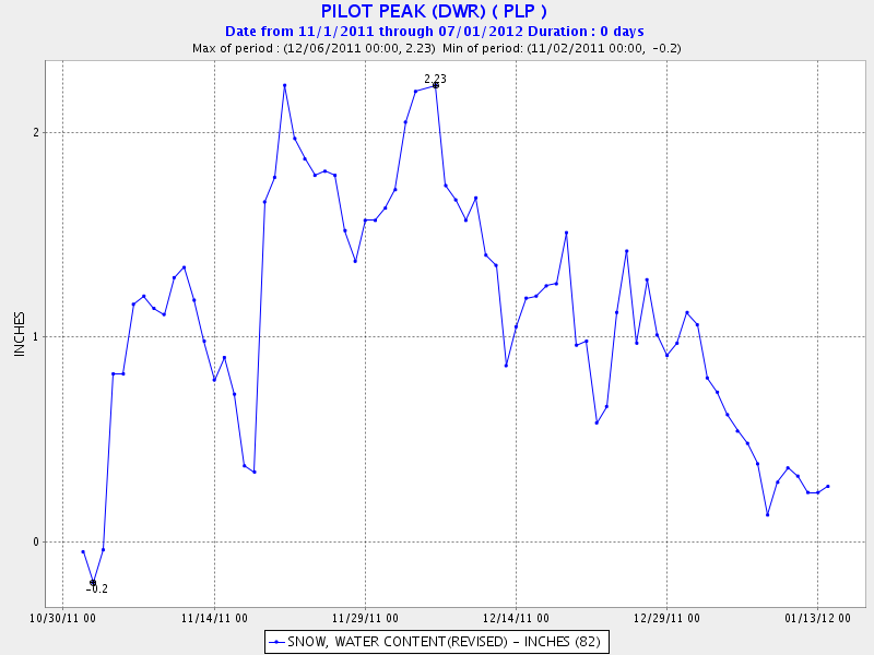
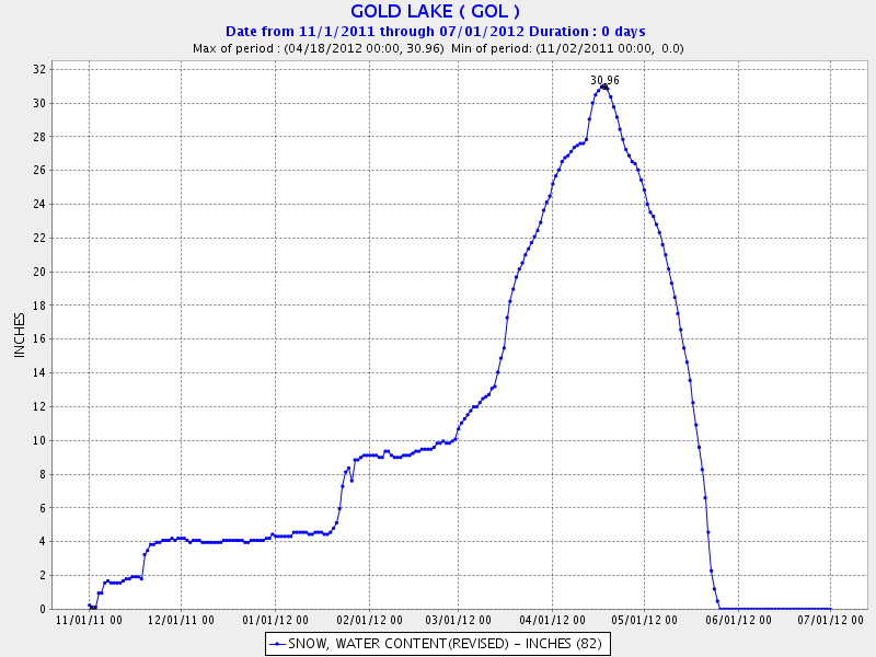
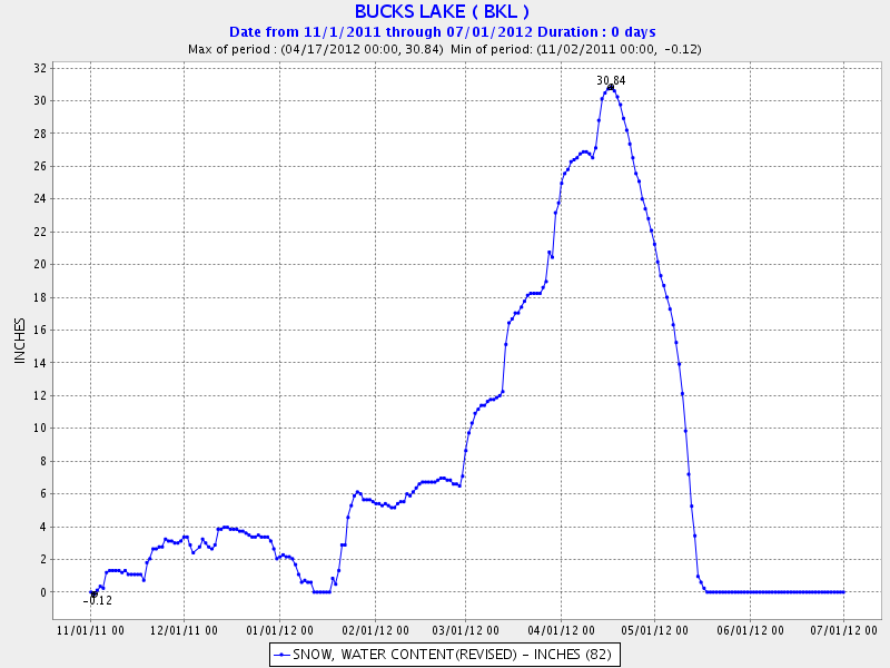
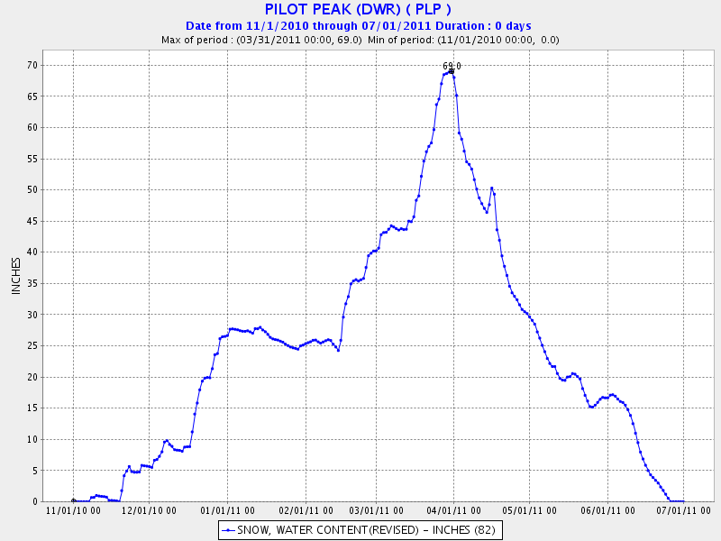
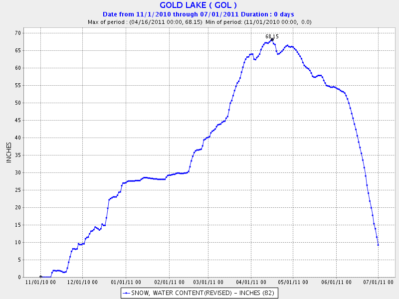
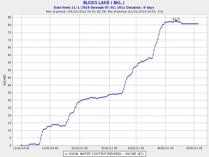
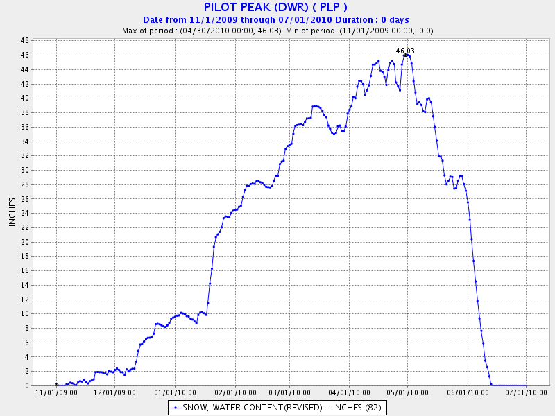
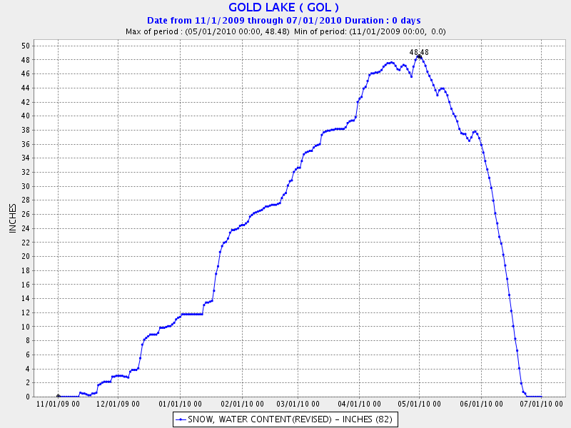
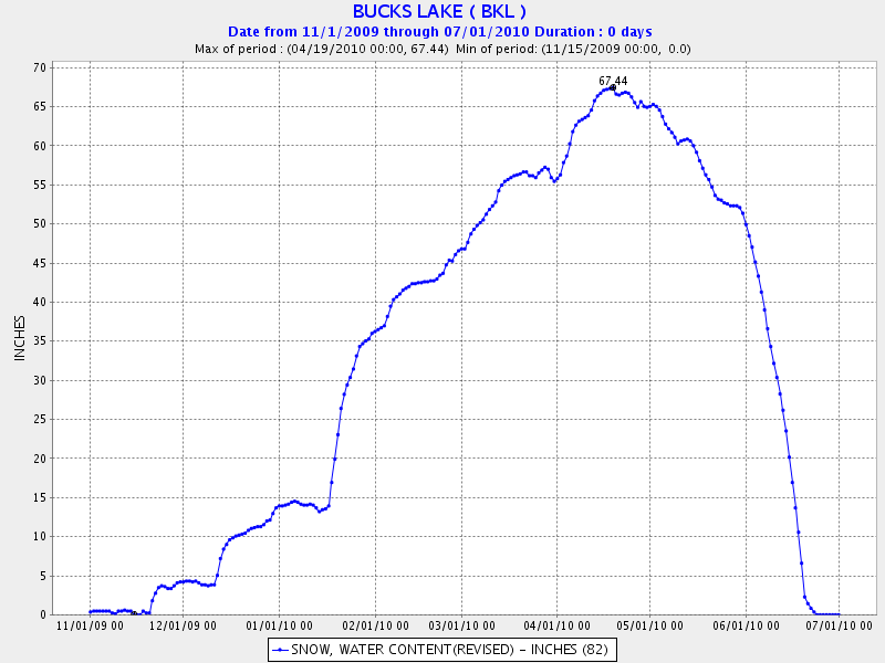
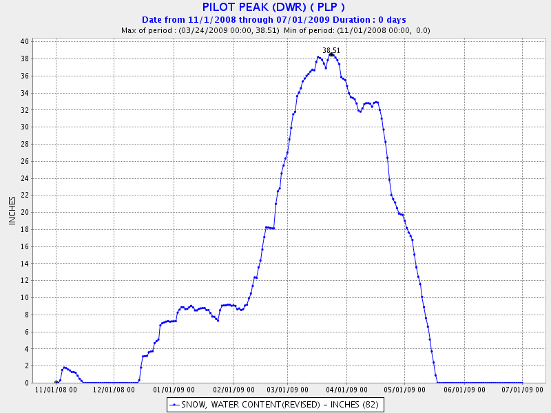
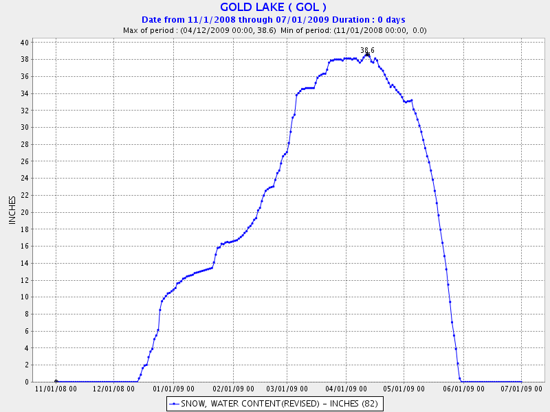
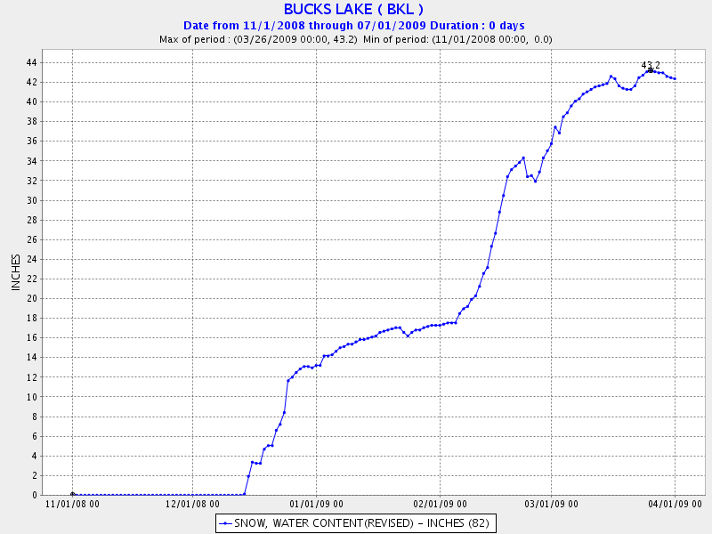
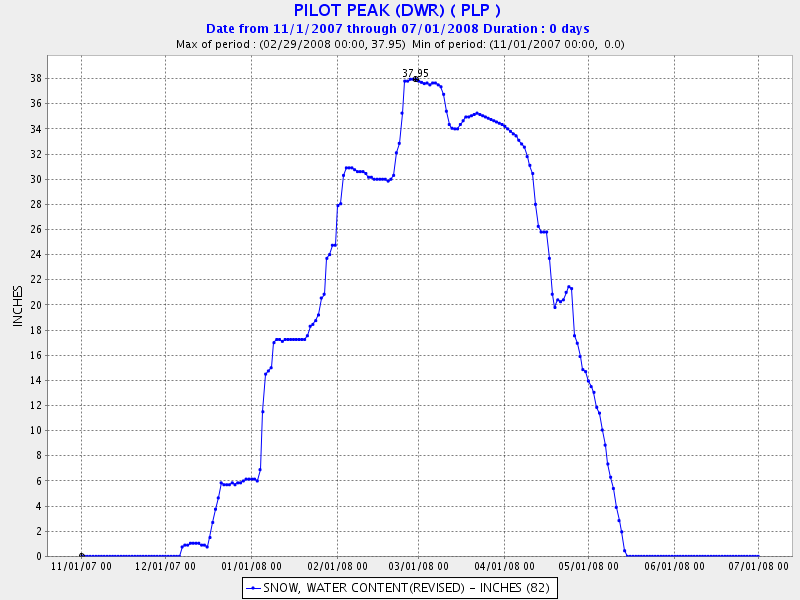
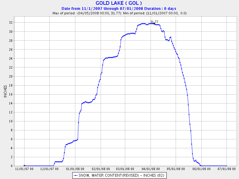
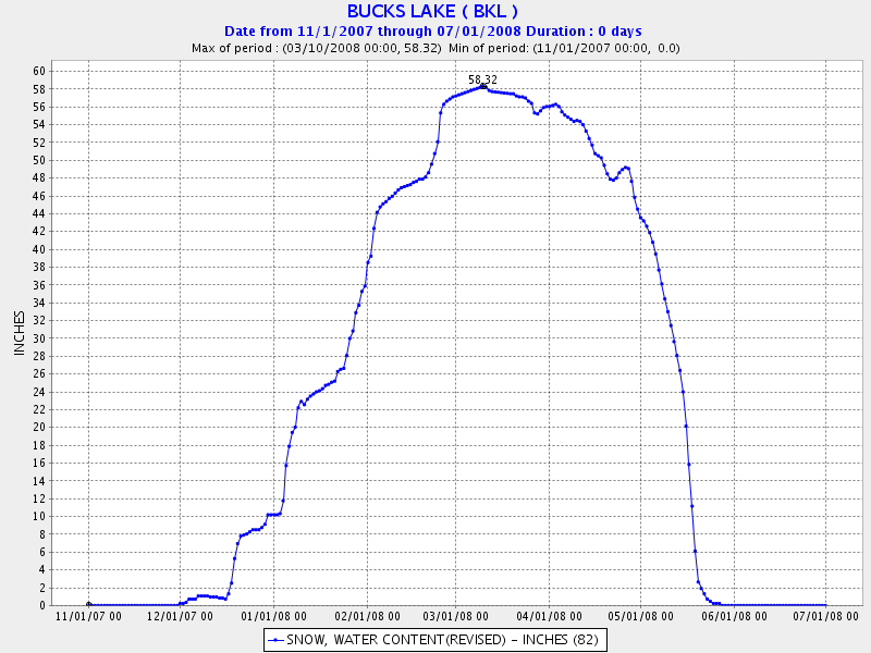
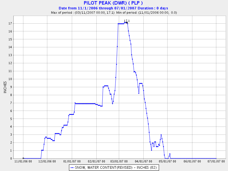
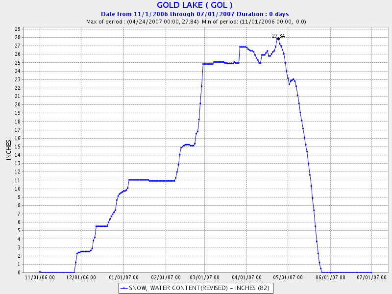
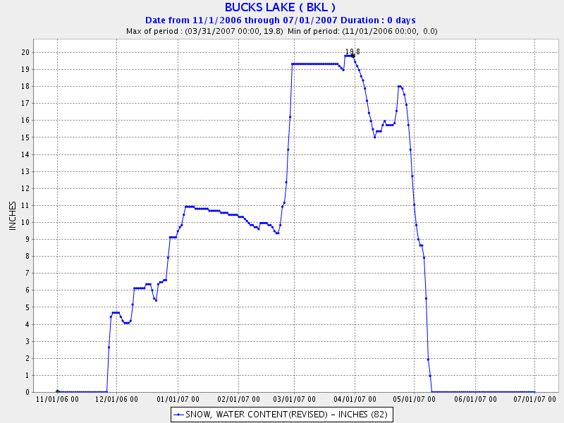
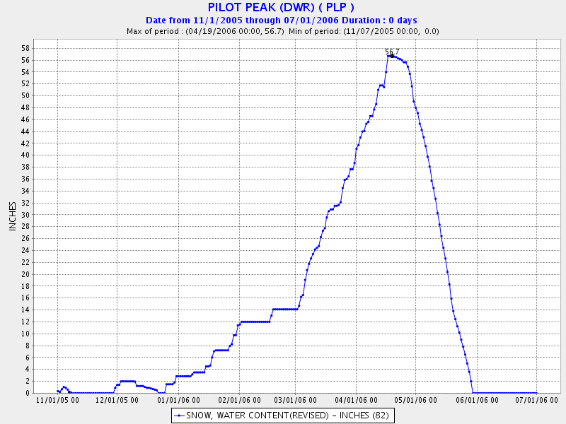
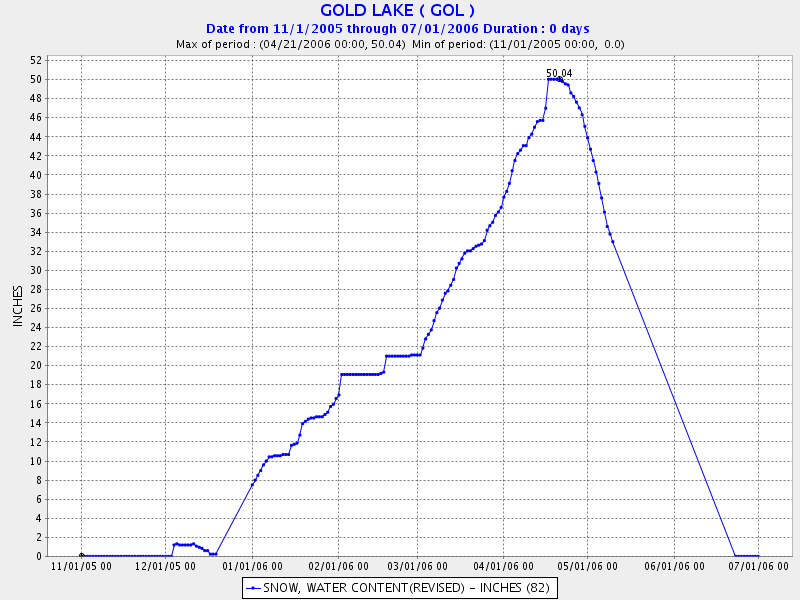
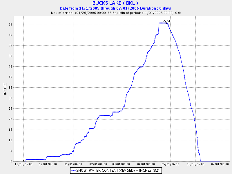
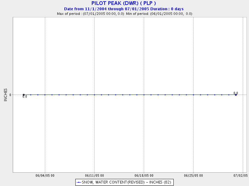
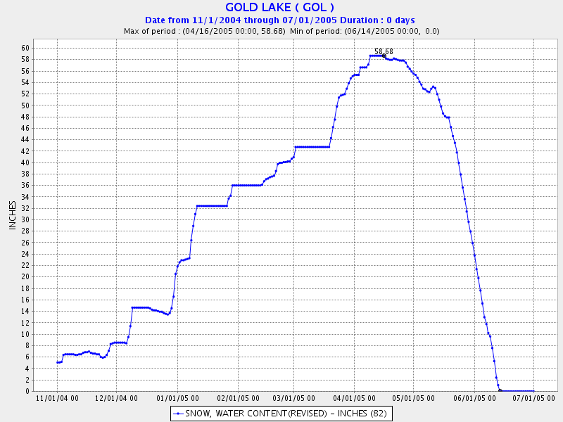
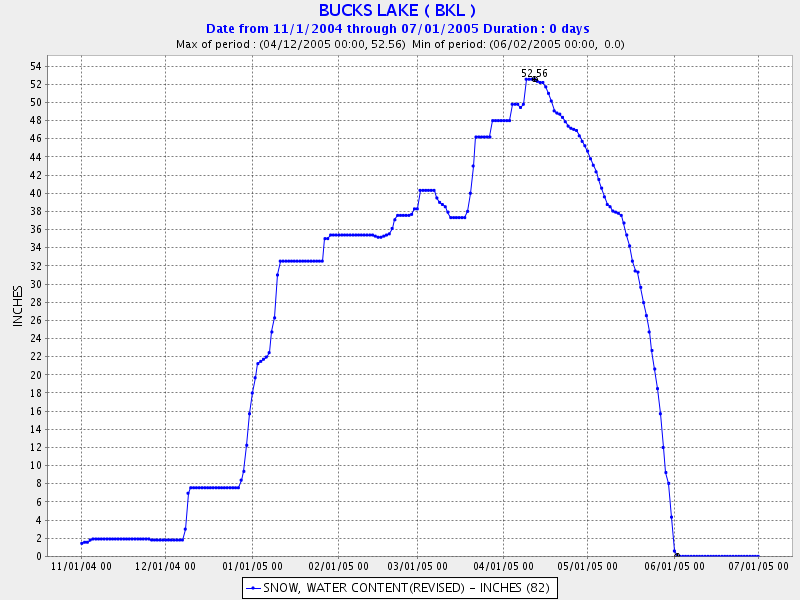
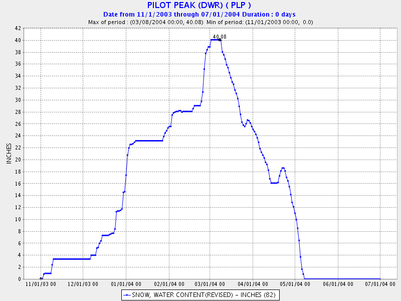
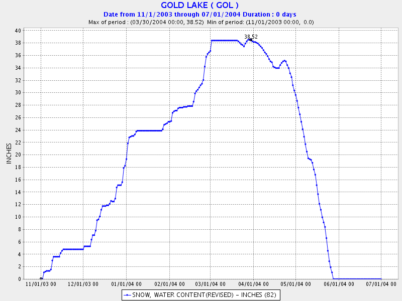
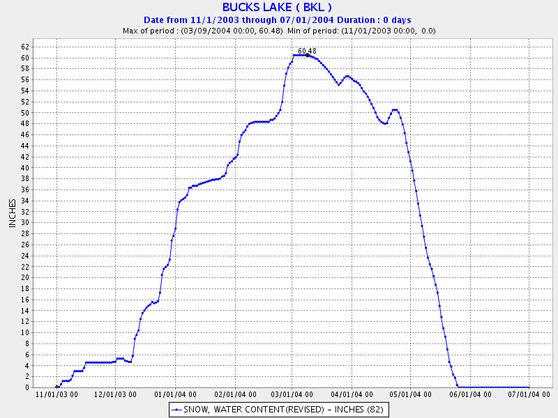
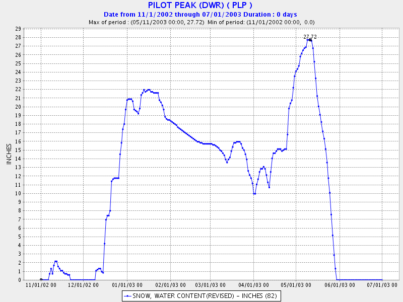
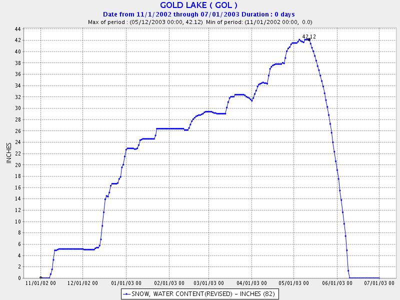
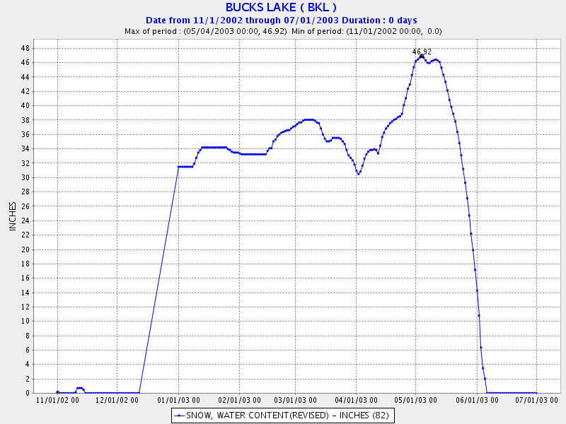
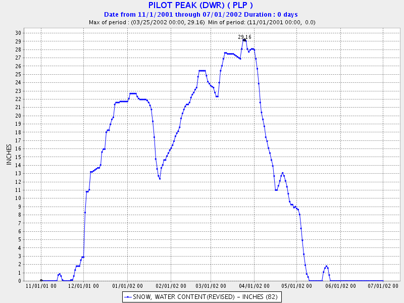
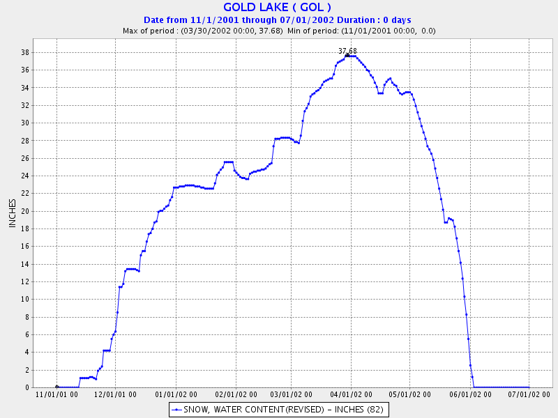
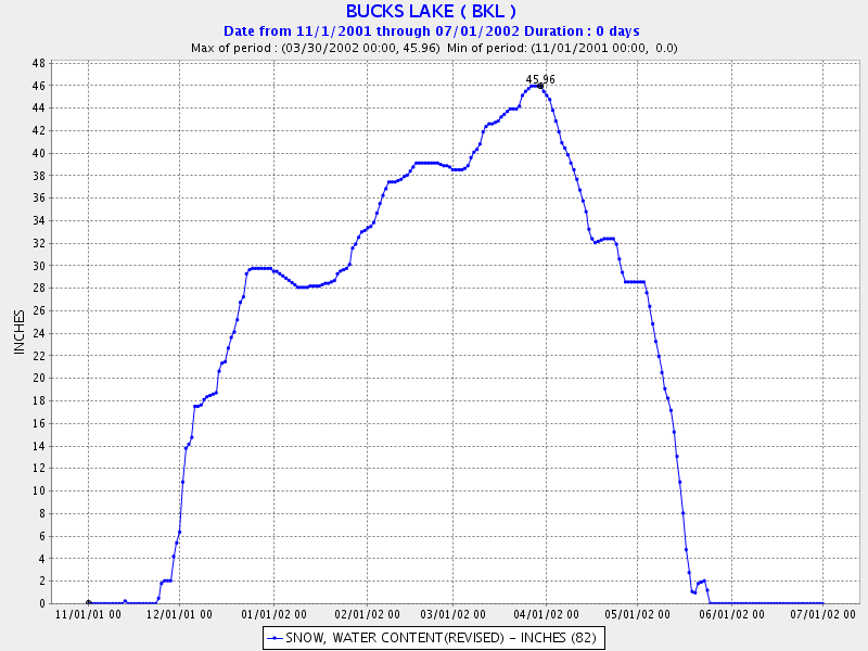
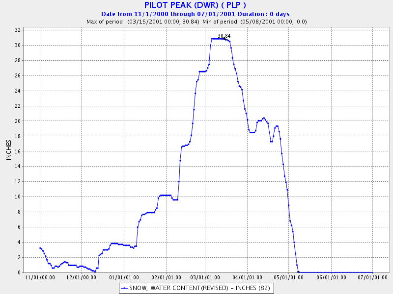
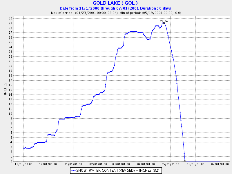
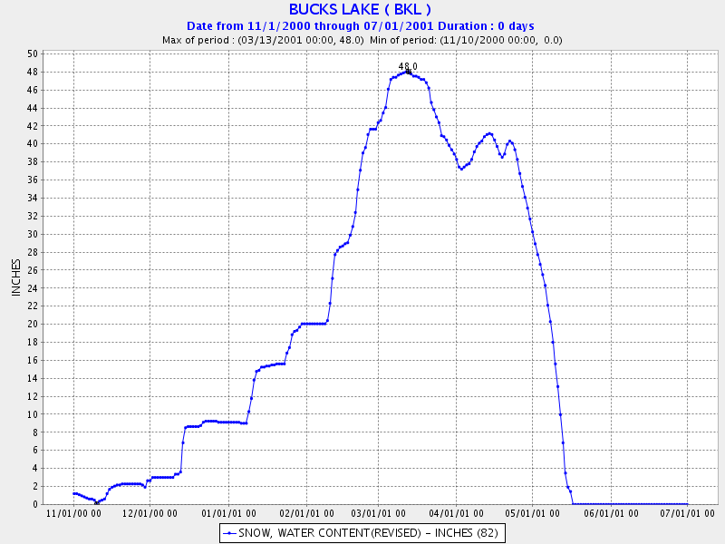
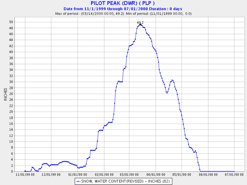
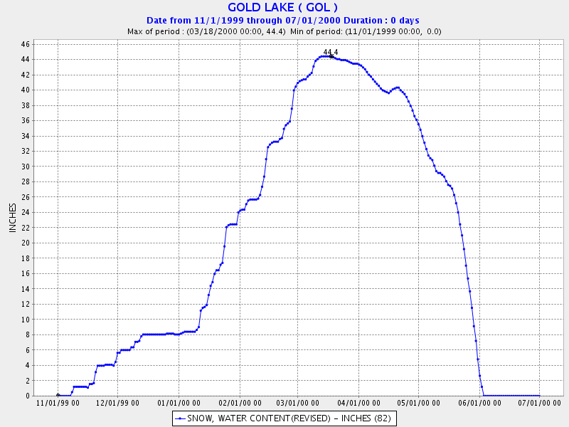
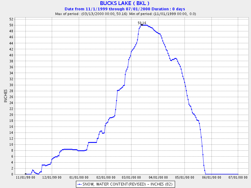
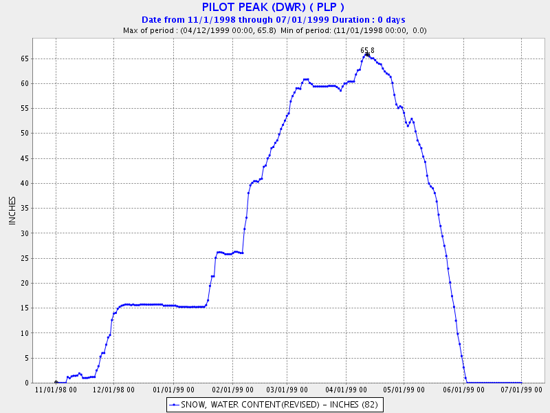
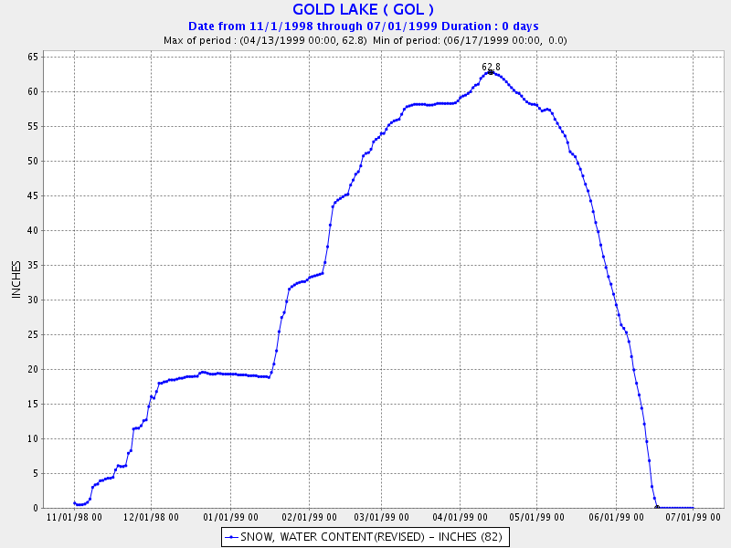
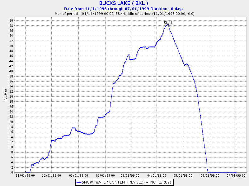
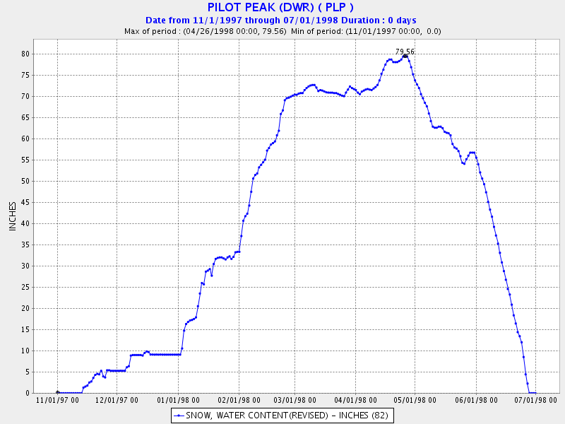
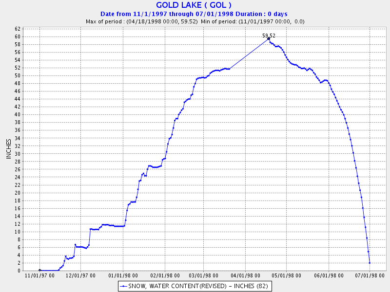
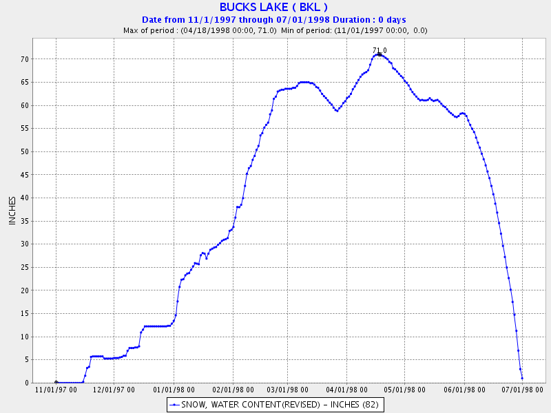
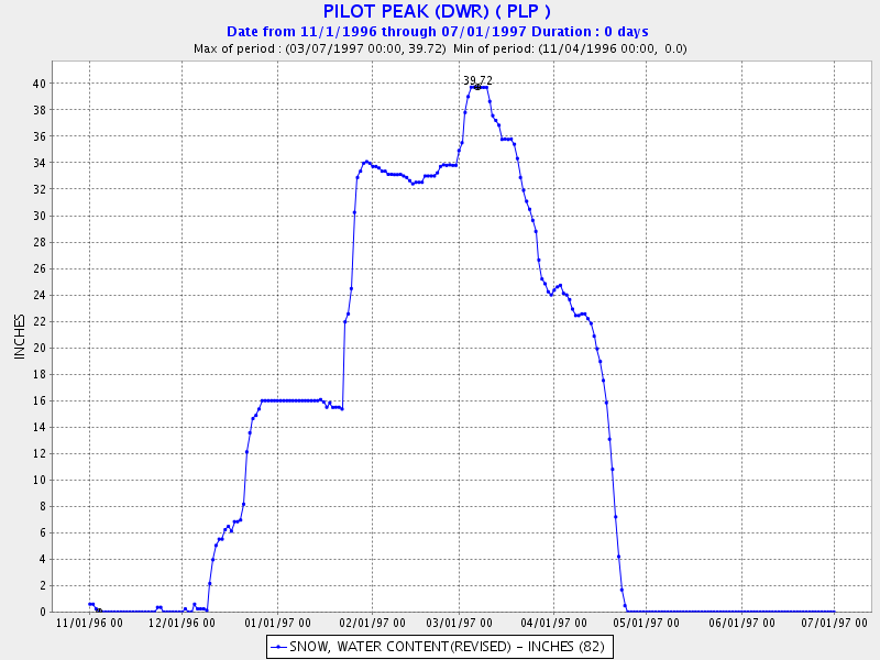
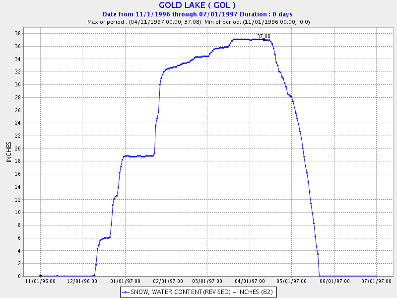
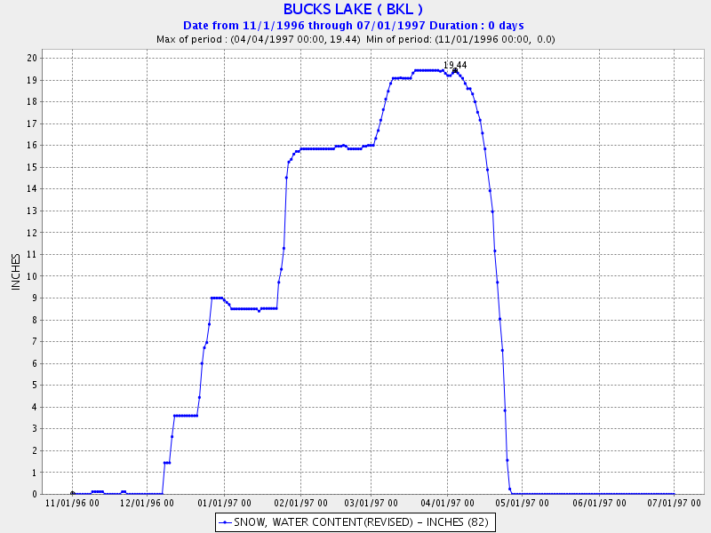
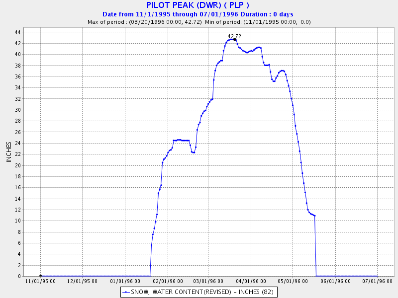
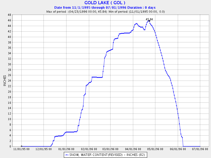
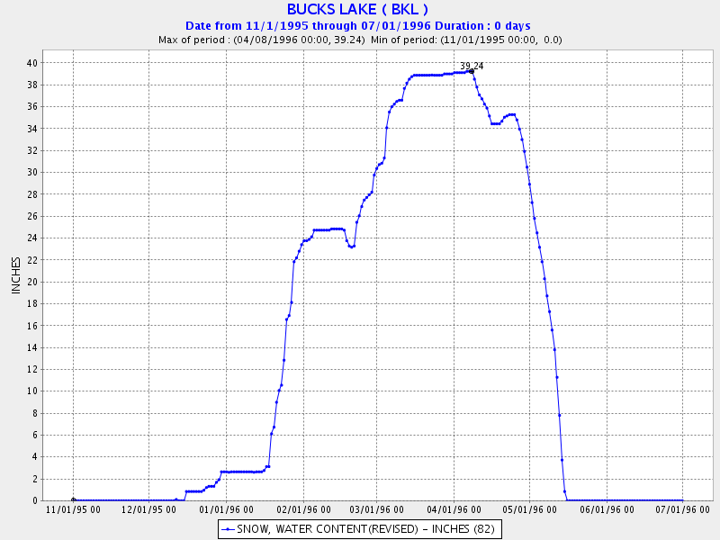
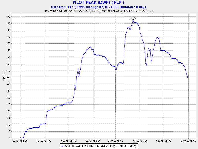
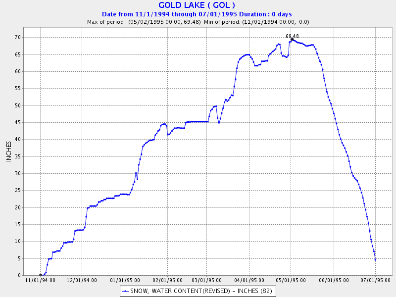
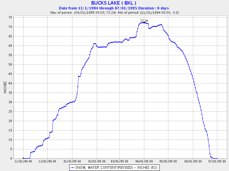
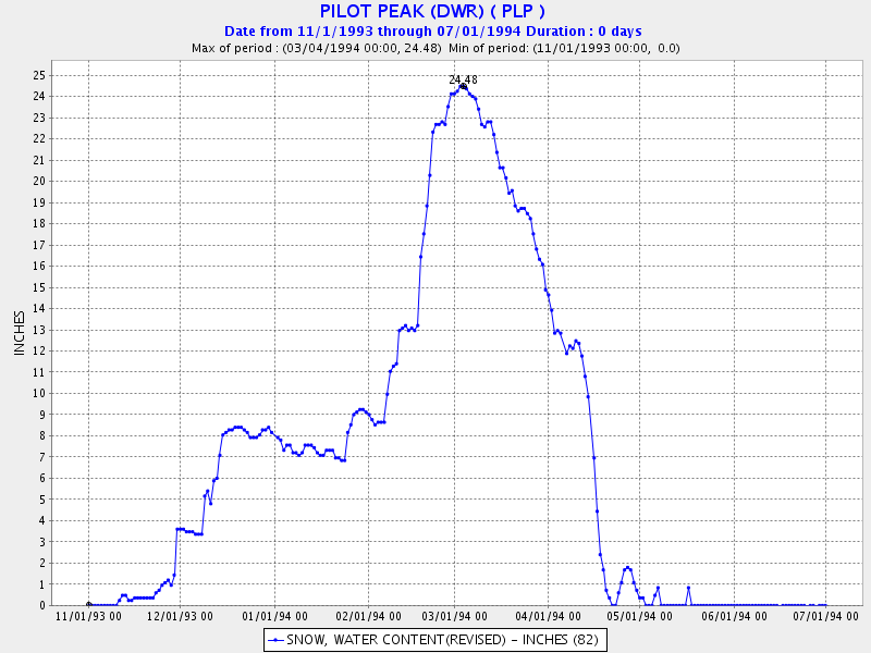
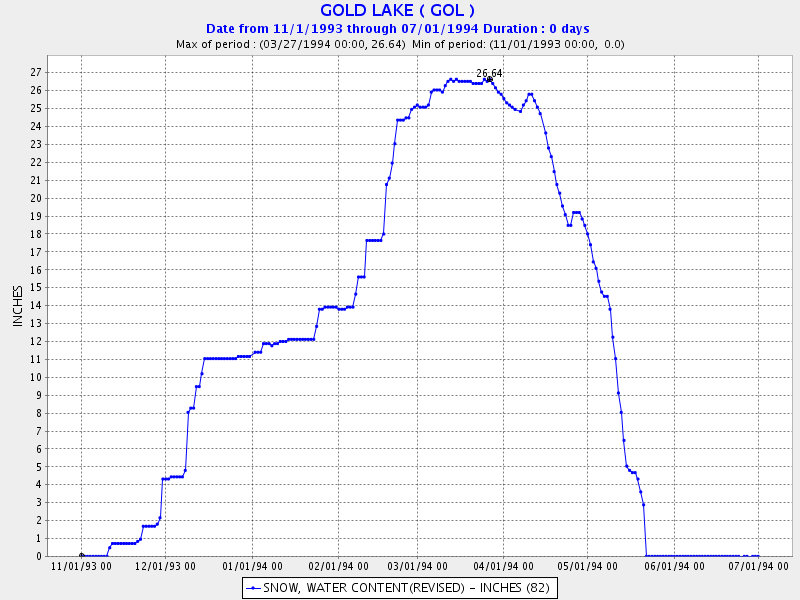
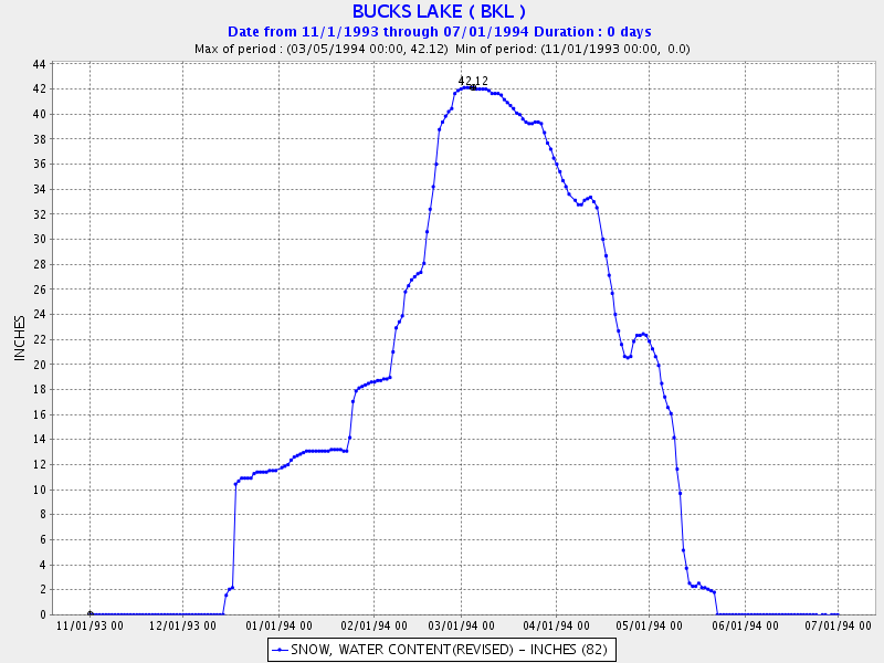
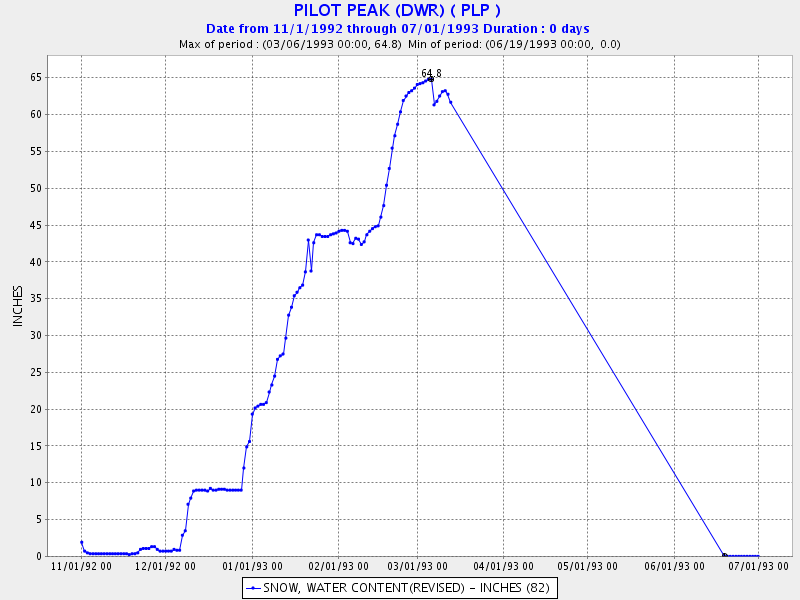
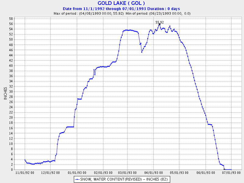
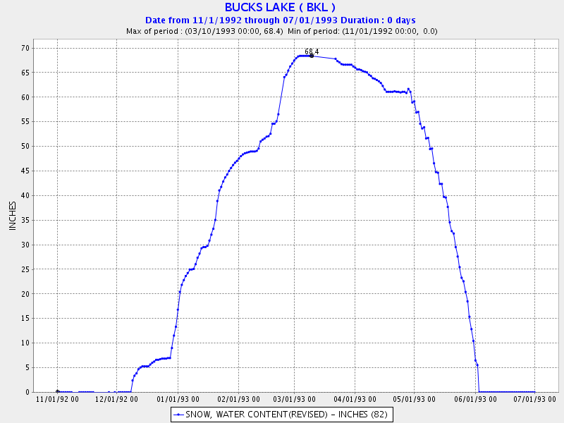
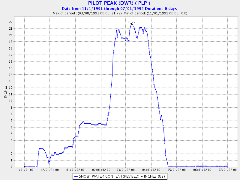
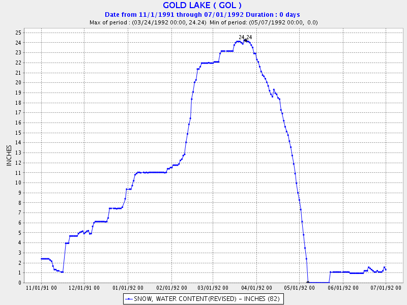
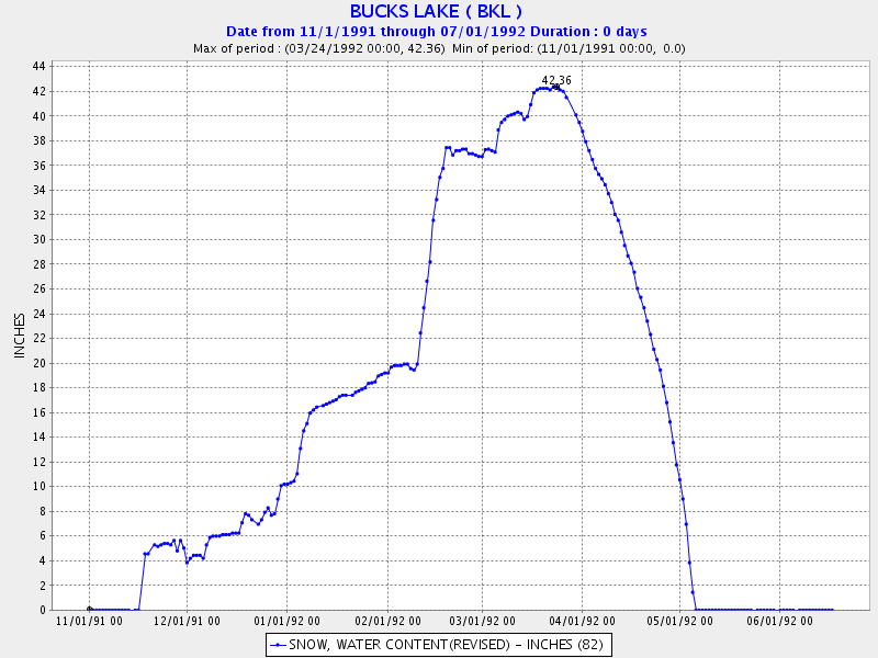
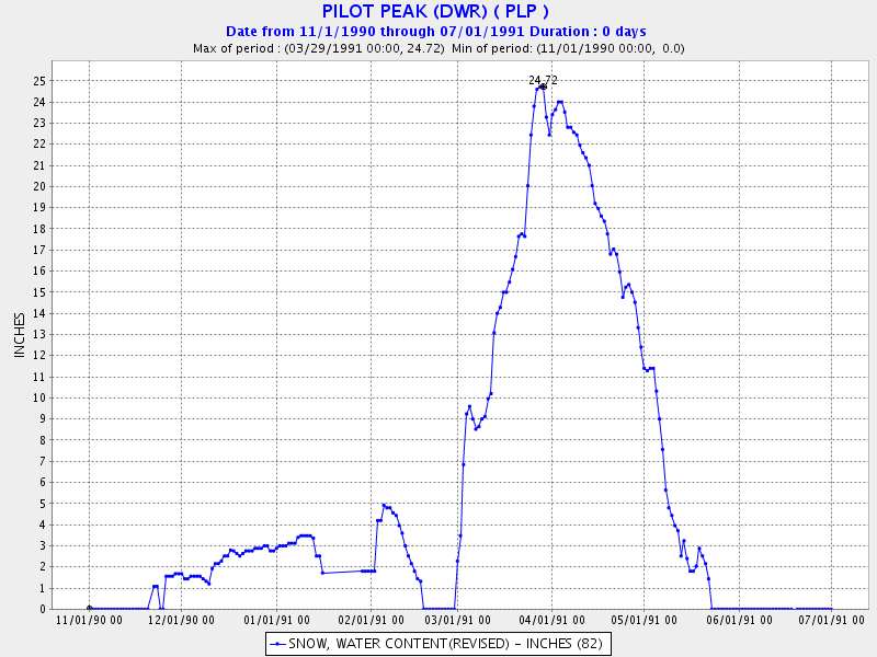
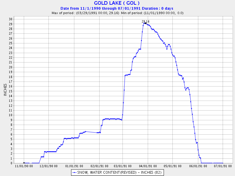
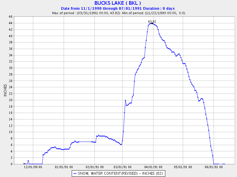
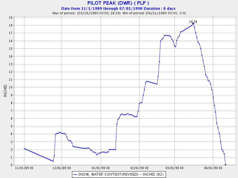
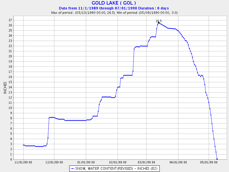
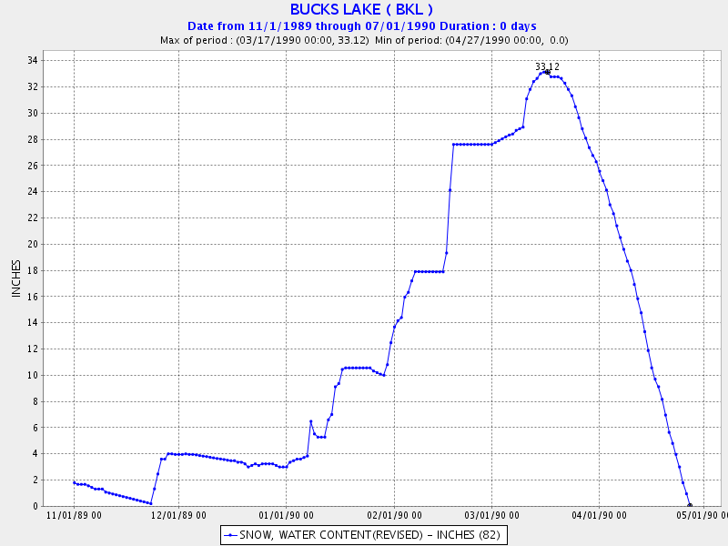
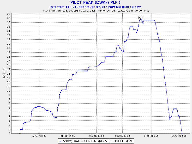
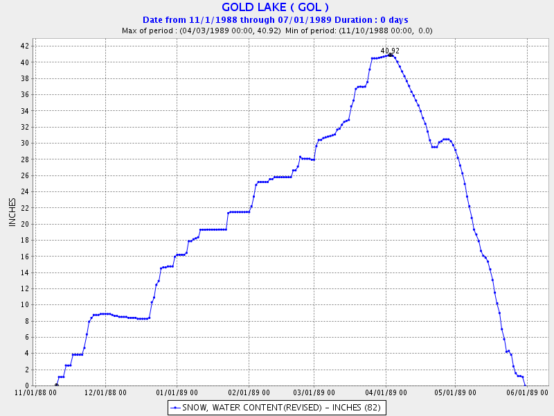
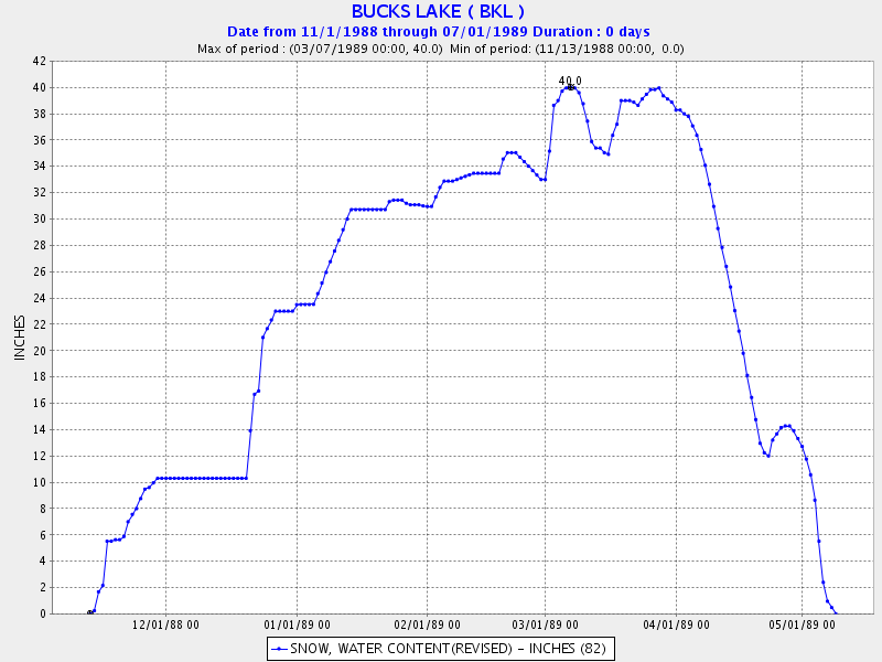
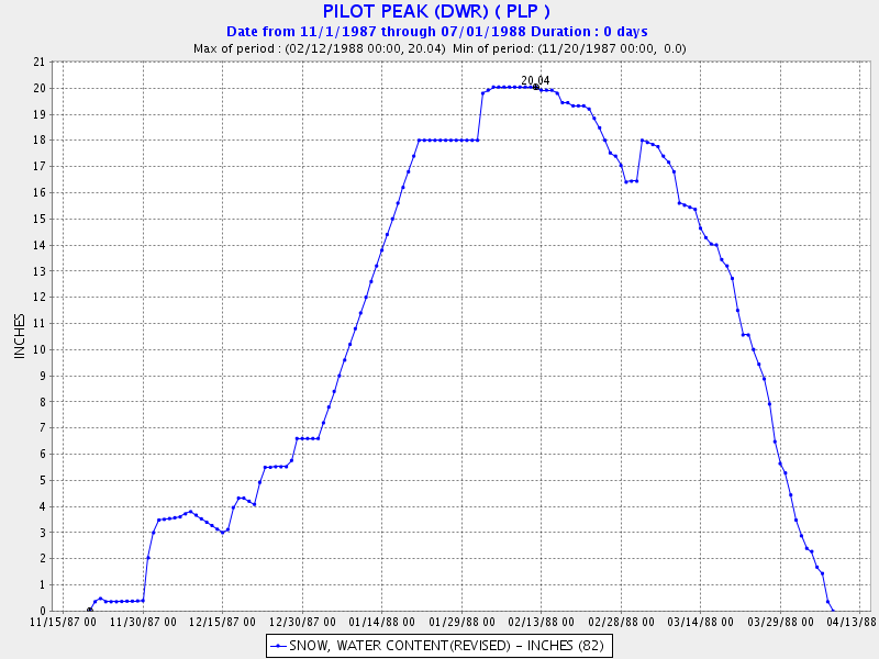
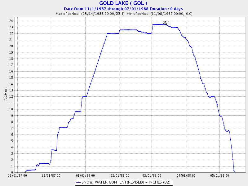
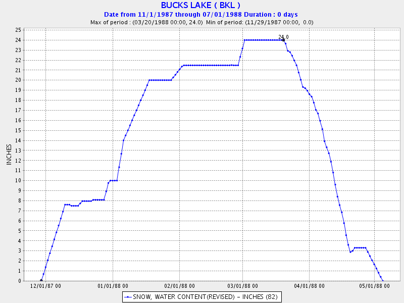
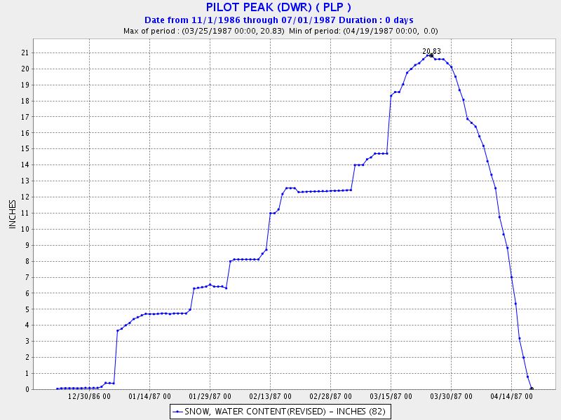
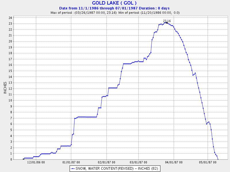
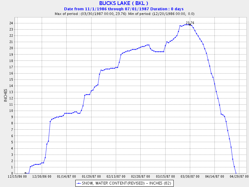
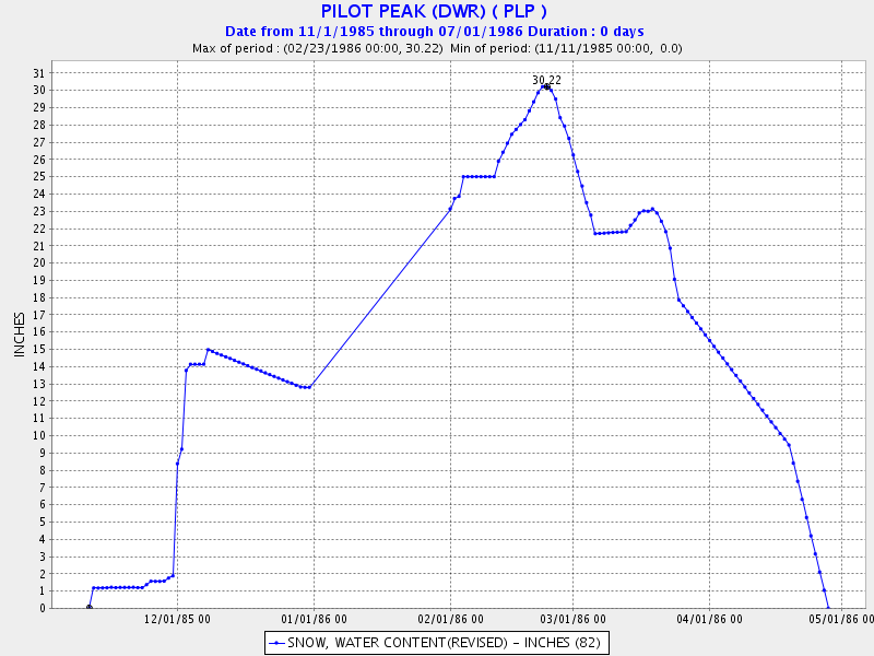
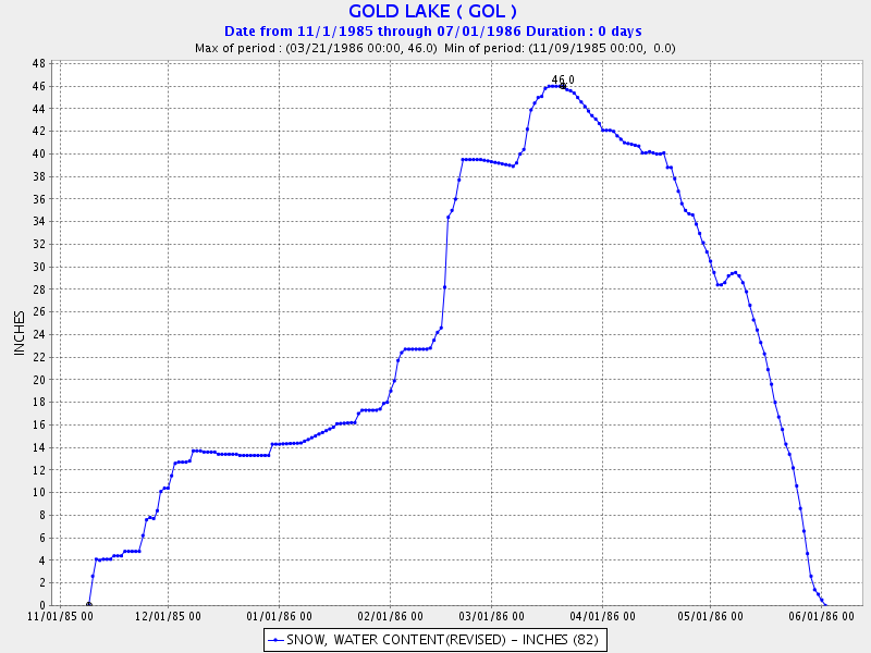
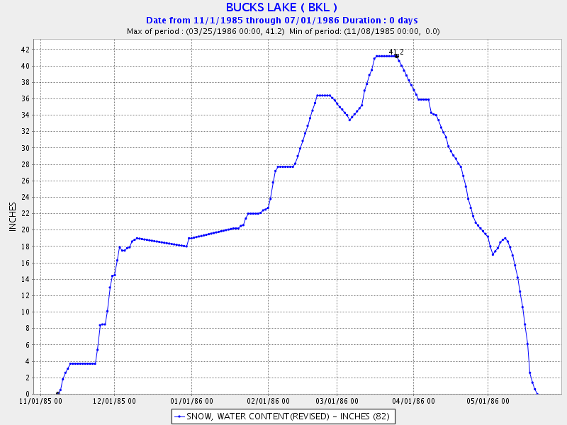
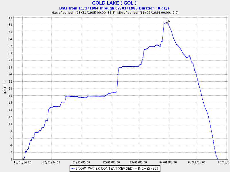
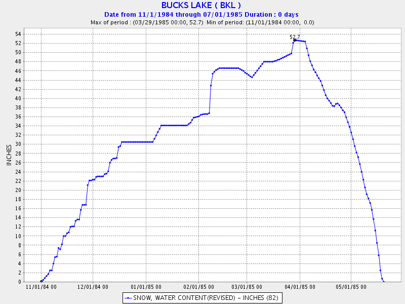
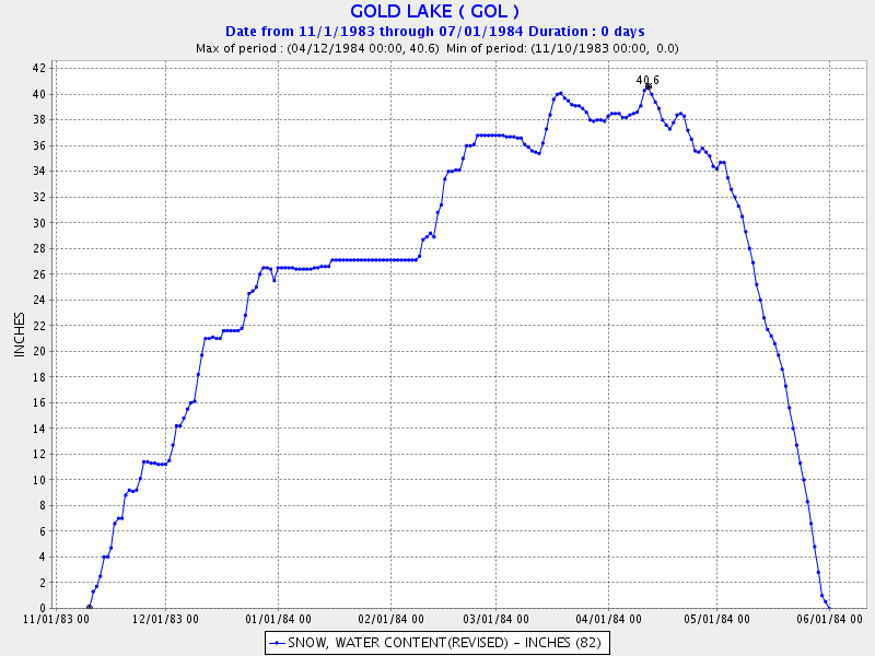
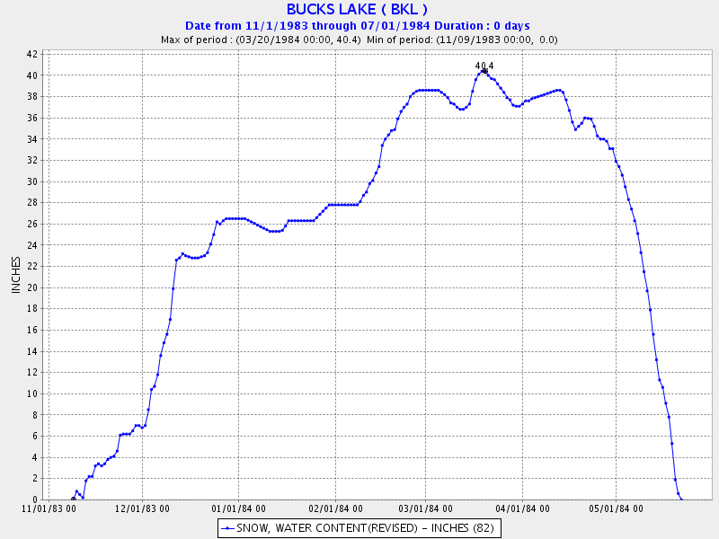
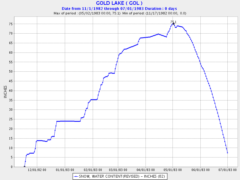
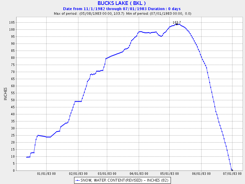
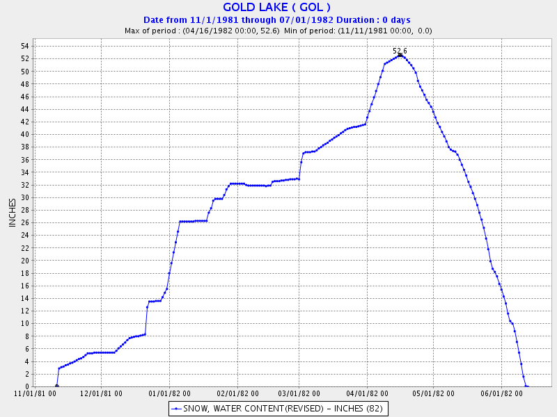
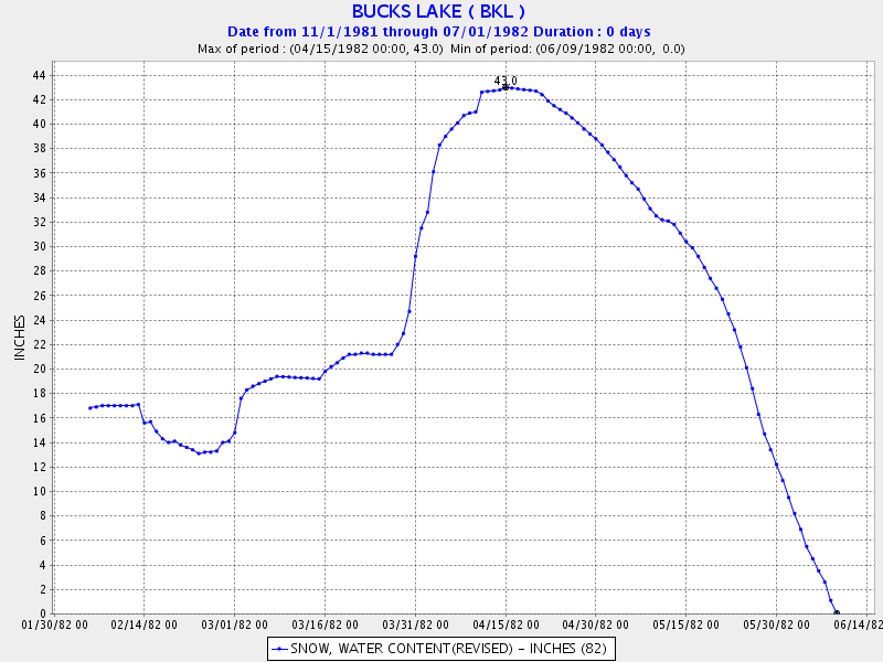
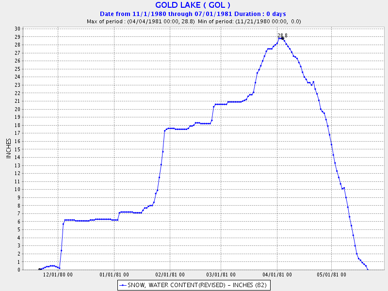
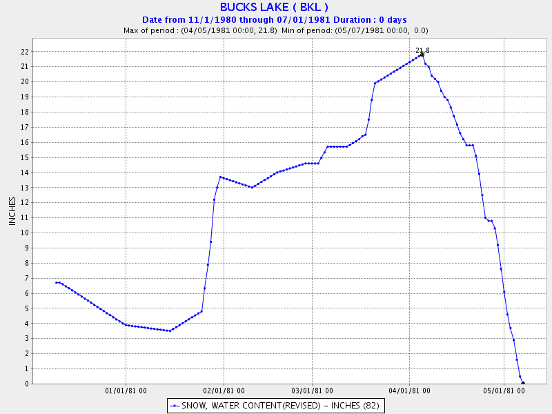
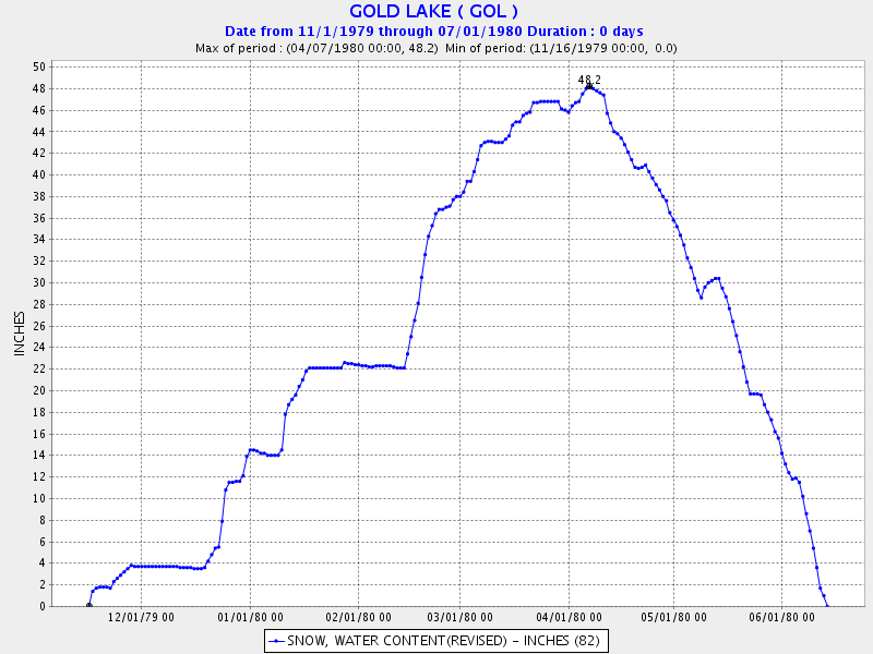
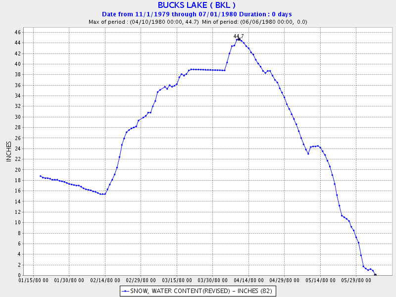
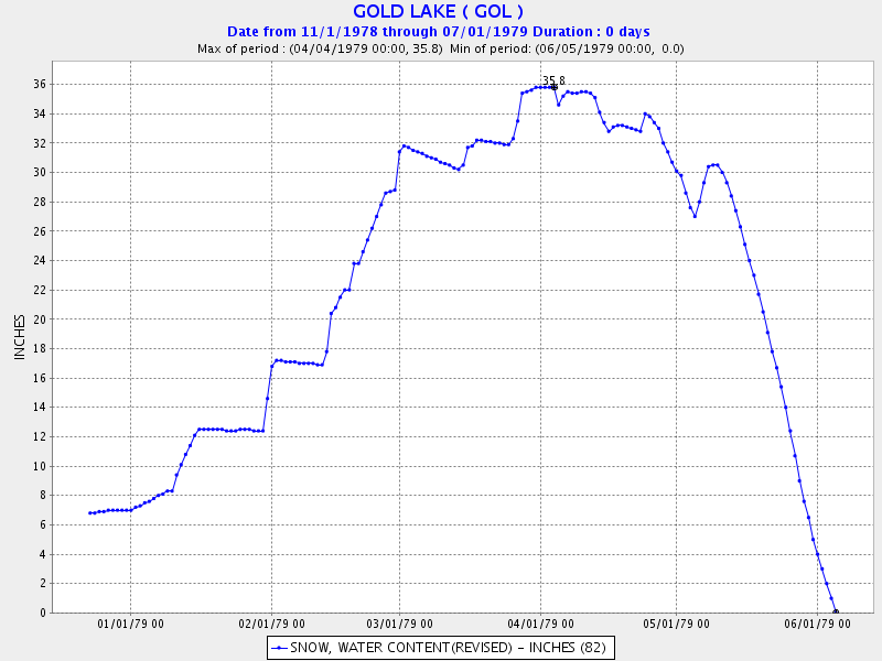
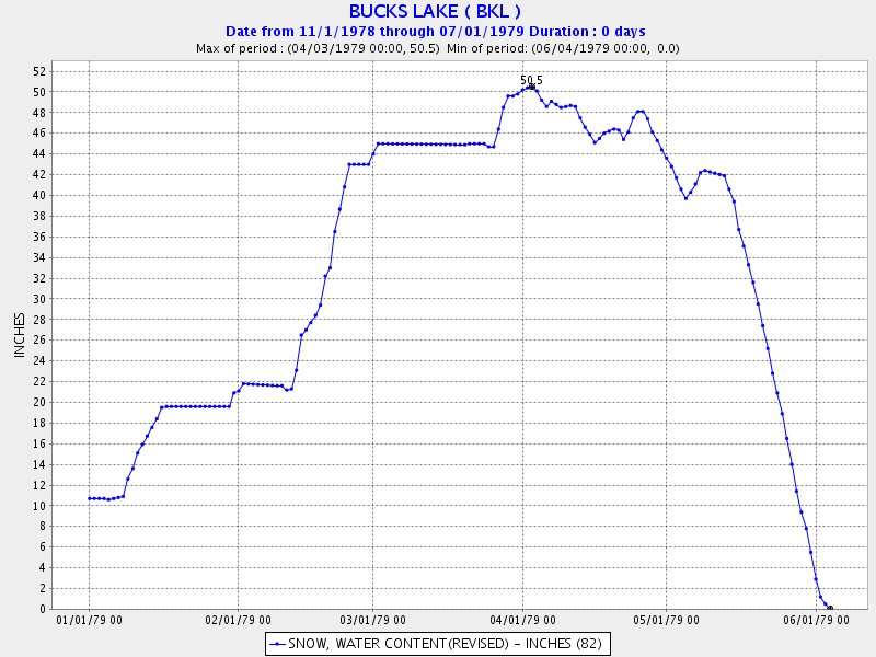
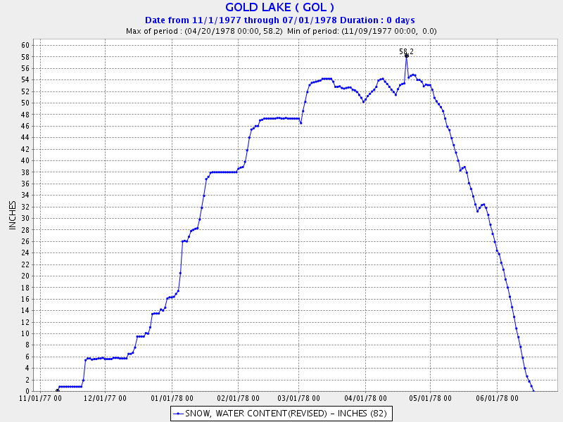
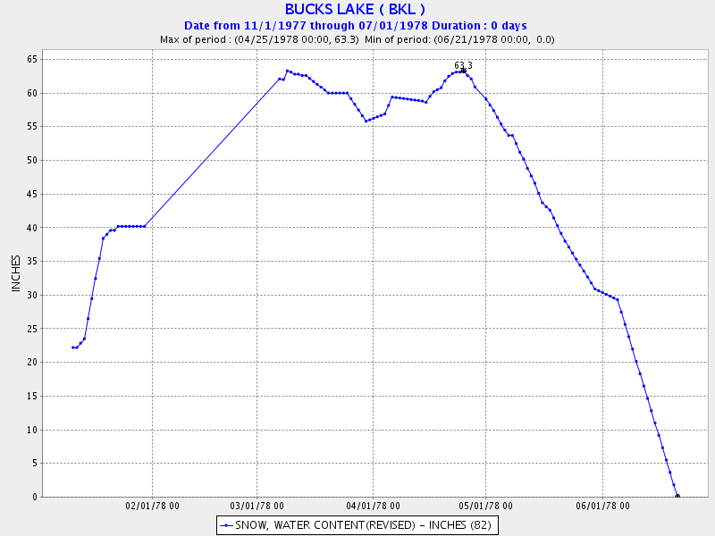
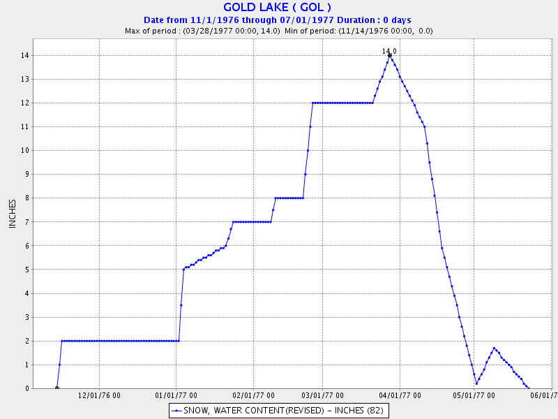
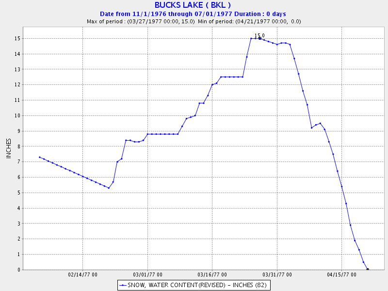
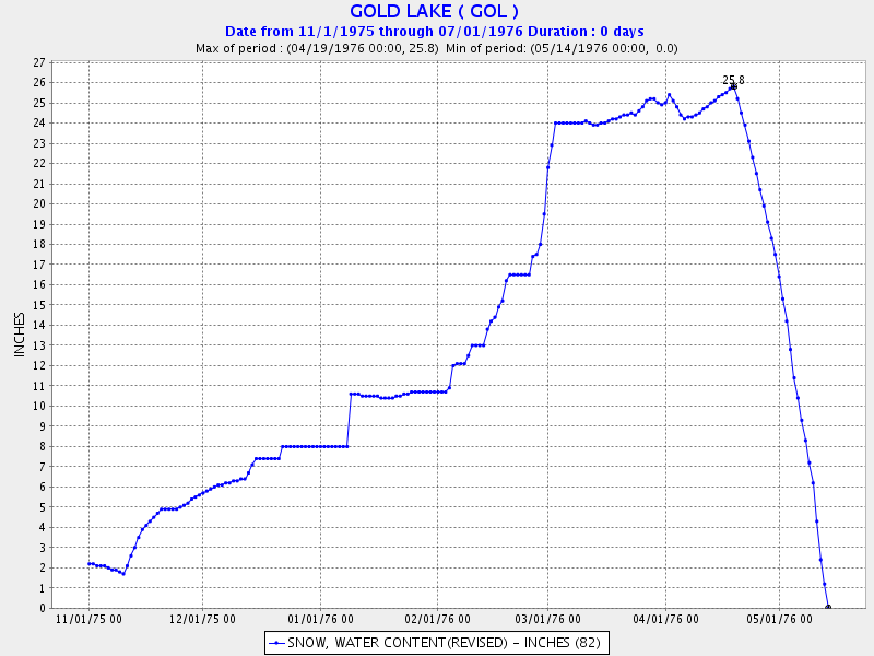
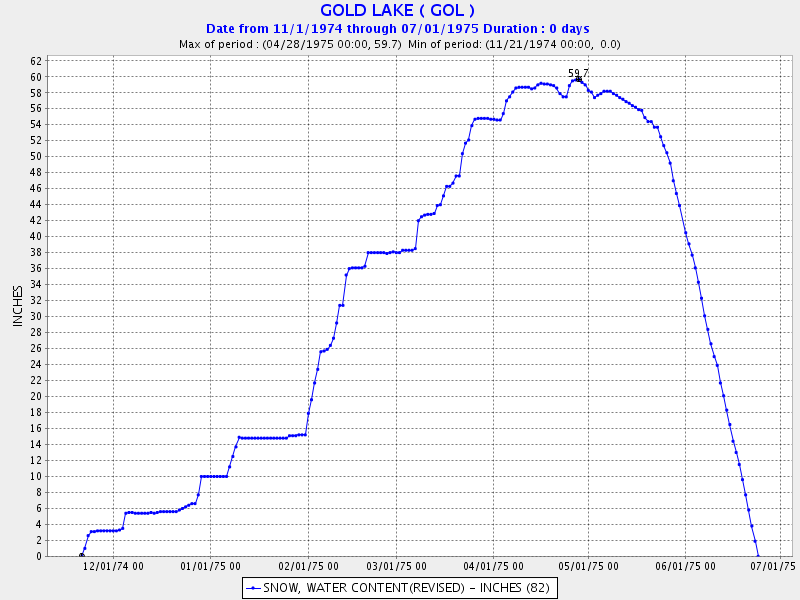
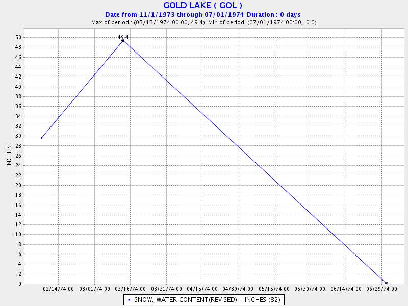
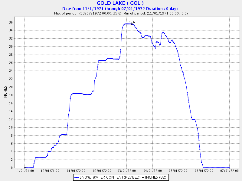
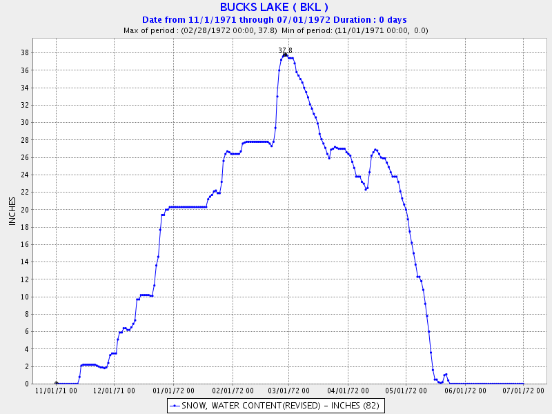
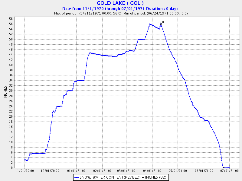
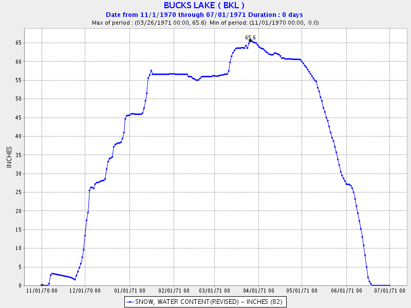
Pilot Peak is closer to the cabin and generally reflects the weather better, but often Gold Lake is a more accurate sensor and its records go farther back. Pilot Peak is about 7.5 miles northeast of the cabin, on the crest. Gold Lake is about 15 miles east of the cabin, over the crest. Buck's is about 10 miles NW.
Taken from the California Department of Water Resources Division of Flood Management Data Exchange Center.
Also, take a look at the snow videos from my webcam.
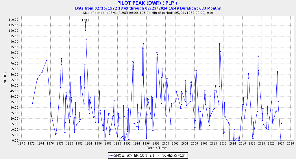
First, the monthly records from Pilot Peak:
And Lexington Hill, above La Porte (this snow course is monthly only):
The annual records: